2023 Map of Anthony
USGS Topo · Published 2023About this map
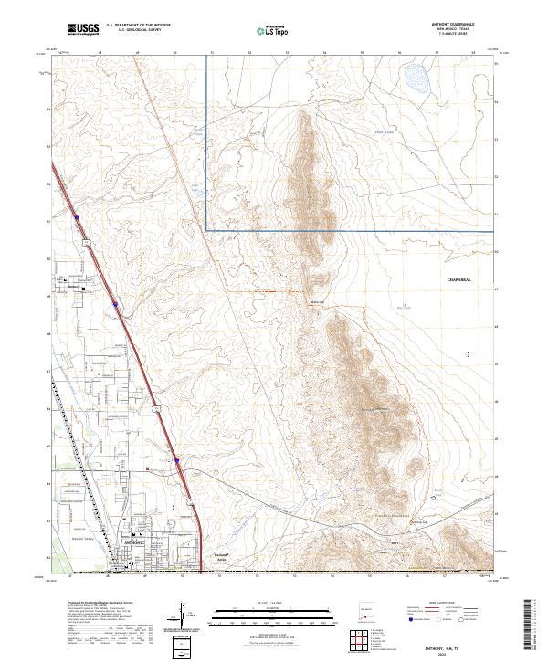
Anthony and Berino anchor the western edge of this 2023 survey, which traces the transition from the irrigated agricultural lands of the Mesilla Valley to the high desert terrain of the Franklin Mountains. The map is particularly valuable for genealogical research, documenting several local burial grounds including the Old Berino Cem, Berino Cem, and the cluster of Saint Anthonys Catholic Cem and Anthony Community Cem near the state line. To the east, the landscape rises toward North Anthonys Nose and the protected lands of the Organ Mountains-Desert Peaks National Monument. Water management in this arid environment is clearly delineated through features like the Anthony Lateral, East Drain, and the network of livestock watering spots such as Beech Tank and Berino Tank. The rugged Anthony Gap provides a natural passage through the peaks, while the suburban growth of Chaparral and Hacienda Acres reflects modern expansion in Doña Ana County.
Find a feature on this map
83 named features on this map. Tap any name to fly to it.
Don’t see what you’re looking for? This feature index may not catch every label — zoom into the map to look around manually.
Map Details
Editions of this 2023 Anthony Map
This is the sole edition of this map. No revisions or reprints were ever made.
Historical Maps of Anthony Through Time
1 maps found