2023 Map of Anton Chico
USGS Topo · Published 2023About this map
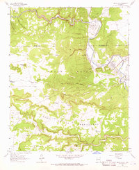
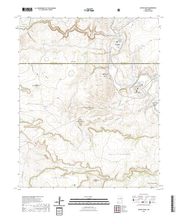
The Pecos River carves a deep valley through the high mesas of Guadalupe and San Miguel Counties, creating a corridor of settlement that includes Anton Chico, Upper Anton Chico, and Tecolotito. This landscape is defined by its dramatic topography, where the river is fed by drainage features like Tecolote Creek and Cañada Ancha. The map captures a tradition of localized ranching and community life, evidenced by the numerous named canyons such as Cañon de la Chamizalosa and Cañon de Montecitos. Genealogy researchers will find significant value in the documentation of local burial sites, including the Old Anton Chico Cem and the Campo Santo de San Jose Cem. The southern reach of the Santa Fe National Forest touches the northwest corner, while distinctive landmarks like Ben Ortiz Peak and Punta de la Mesa provide clear navigation points across the broad expanses of the Mesa de la Chamizalosa.
Find a feature on this map
46 named features on this map. Tap any name to fly to it.
Don’t see what you’re looking for? This feature index may not catch every label — zoom into the map to look around manually.
Map Details
Editions of this 2023 Anton Chico Map
This is the sole edition of this map. No revisions or reprints were ever made.