Old Maps of Guadalupe County, New Mexico
Explore 405 old maps of Guadalupe County, spanning from 1890 to today. These high-resolution historic maps reveal how streets, neighborhoods, landmarks, and natural features evolved over time — perfect for genealogy, metal detecting, research, and local history exploration.
What you can do with these maps:
- See how Guadalupe County changed over time: Compare historical maps to modern-day views to trace roads, homesites, rail lines & more.
- View detailed metadata: Each map includes creators, publishers, year, scale, and archive source.
- Overlay maps with satellite & LiDAR: Visualize the past alongside modern tools to explore terrain & human change.
- Trusted historical sources: Maps sourced from the USGS, Library of Congress, and other archives.
- Access maps your way: View online, download high-res files, or order prints for personal or research use.
Start exploring old maps of Guadalupe County to uncover forgotten places, hidden landmarks, and the deep history beneath your feet.
Guadalupe County, NM maps
(405)- 1890 Map of Bernal, 1956 Print
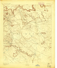
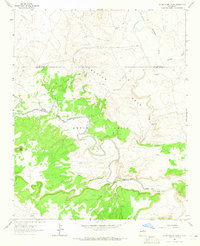
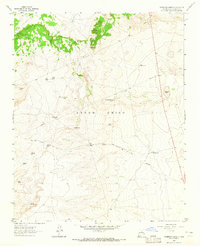
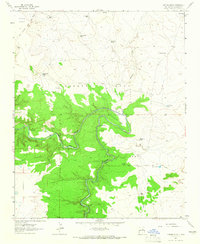
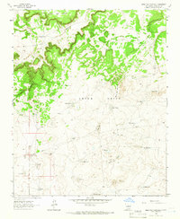
 1890 Bernal1956 Print · USGSSettlements along the Pecos River valley and the critical rail corridor of the late nineteenth century define this New Mexico landscape. Researchers can trace the early rail stops and traditional plazas of San Miguel, Old Bernal, and Anton Chico.
 - 1891 Map of Bernal
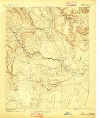
 1891 Bernal1891 Print · USGSNorthern New Mexico's river valleys and mesa lands are captured here just as the railroad began transforming the territory's commerce. Genealogists can trace family roots in historic plazas like San Miguel, La Cuesta, and San Jose before modern development changed these rural corridors.
 - 1892 Map of Corazon
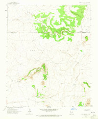
 1892 Corazon1892 Print · USGSSan Miguel County in the early 1890s reveals a territory of high mesas and vital water sources before modern development. Genealogists and researchers can locate early plazas and villages such as Chaperito, Aguila, and Las Colonias, or trace family landmarks like Cabra Spring.2 unique versions available
 - 1894 Map of Corazon
 1894 Corazon1894 Print · USGSSan Miguel county in the 1890s was a landscape of high mesas and vital river settlements. Genealogists and historians can trace early territory life through named springs and remote outposts like Chaperito, Las Colonias, and Concha Spring.5 unique versions available
 - 1894 Map of Bernal
 1894 Bernal1894 Print · USGSSan Miguel County at the end of the nineteenth century is captured here as the railroad began to reshape the old river settlements. Genealogists can trace family roots in historic villages like Old Bernal, Anton Chico, and La Liendre.4 unique versions available
 - 1954 Map of Santa Fe, 1963 Print
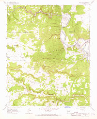
 1954 Santa Fe1963 Print · USGSNew Mexico's high mountains and eastern plains meet in the mid-fifties, showing a landscape defined by the Sangre de Cristo Mountains and the Pecos River. Trace family roots and local history through San Christobal Church, Sena School, and the historic Las Vegas rail corridor.4 unique versions available
 - 1954 Map of Fort Sumner, 1964 Print
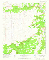
 1954 Fort Sumner1964 Print · USGSEast-central New Mexico's ranching and rail heartland is captured here in the mid-1950s, centered on the strategic junctions of the high plains. Researchers can trace the development of early highway networks and rail towns like Vaughn, Fort Sumner, and the copper operations at Guadalupe Mine.3 unique versions available
 - 1958 Map of Fort Sumner
 1958 Fort Sumner1958 Print · USGSEast-central New Mexico in the mid-fifties is captured here as a sprawling landscape of high mesas and cattle ranching. Researchers can trace the convergence of the Southern Pacific railroad at Vaughn and locate family landmarks like Borica School or Marquez Ranch.
 - 1958 Map of Santa Fe
 1958 Santa Fe1958 Print · USGSThe Sangre De Cristo Mountains meet the high plains in the late 1950s, showing a landscape defined by rail corridors and ranching. Genealogists can trace family-named sites like Upton Ranch or visit the Fort Union (Ruins) and Tuloso School.
 - 1963 Map of Colonias, 1965 Print
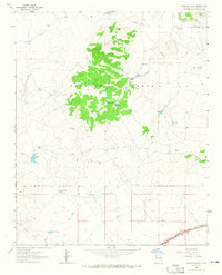
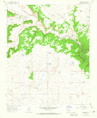 1963 Colonias1965 Print · USGSThe Pecos River valley in the early 1960s reveals a landscape of traditional land grants and family-run cattle operations. Genealogists can trace localized settlements like Colonias and El Cerrito, or locate specific family holdings such as the Manuel Ulibarri Ranch.2 unique versions available
 - 1963 Map of Santa Rosa, 1965 Print
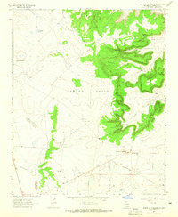
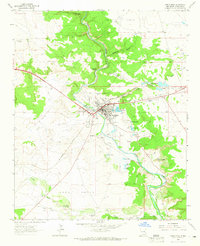 1963 Santa Rosa1965 Print · USGSSanta Rosa and the surrounding Pecos River valley are captured here in the early sixties, showing a landscape defined by historic water rights and rail transport. Researchers can trace the town’s development via the Southern Pacific tracks and locate several community landmarks including Blue Hole and St Rose of Lima Cem.2 unique versions available
 - 1963 Map of Pedro Miguel Peak, 1965 Print
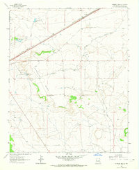
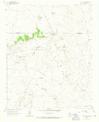
 1963 Pedro Miguel Peak1965 Print · USGSGuadalupe and San Miguel counties are captured in the early 1960s as the high desert landscape was defined by large land grants and cattle ranching. Trace the intersections of the Anton Chico Grant and remote outposts like Sowell Ranch and North Camp.
 - 1963 Map of Puerto Creek, 1965 Print
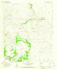
 1963 Puerto Creek1965 Print · USGSGuadalupe County's river valley comes to life in the early sixties, showing the vital irrigation network along the Pecos River. Genealogists and local historians can trace the community of Puerto de Luna, including the Puerto de Luna Sch and Nuestra Señora de Refugio Cem.2 unique versions available
 - 1963 Map of Sunshine Mesa, 1965 Print
 1963 Sunshine Mesa1965 Print · USGSGuadalupe County ranch lands and rail corridors are captured here in the early sixties, showing the high-desert terrain before modern developments. Researchers can trace historical boundaries like the East Boundary Jose Perea Grant or locate specific ranching infrastructure at Moorhouse Ranch and Los Tanos.
 - 1963 Map of Puerto De Luna, 1965 Print
 1963 Puerto De Luna1965 Print · USGSGuadalupe County ranching and irrigation are captured here in the early 1960s. Researchers can trace the layout of Puerto de Luna, the Nuestra Señora de Refugio Cem, and the historic East Puerto de Luna Ditch.2 unique versions available
 - 1963 Map of Thompson Ranch, 1965 Print
 1963 Thompson Ranch1965 Print · USGSGuadalupe County ranching territory is captured here in the early sixties, showing a landscape shaped by water management and vast land grants. Researchers can trace family-named landmarks and water sources like Thompson Ranch, Baker Lake, and Molina Moulton Tank.
 - 1963 Map of Mesa Cherisco, 1965 Print
 1963 Mesa Cherisco1965 Print · USGSThe ranchlands along the San Miguel and Guadalupe county line are captured here in the early sixties. Researchers can trace the water-dependent settlement of this high plateau through family landmarks like Boylan Ranch, Pino Spring, and the prominent Mesa Cherisco.2 unique versions available
 - 1963 Map of Sacaton Draw, 1965 Print
 1963 Sacaton Draw1965 Print · USGSGuadalupe County ranching and rail infrastructure are captured here in the early sixties. Genealogists and historians can trace the Preston Beck Grant boundary and find local landmarks like Ratcliff Ranch, Gonzales Camp, and the Los Tanos Cem.
 - 1963 Map of Horse Pasture Tank, 1965 Print
 1963 Horse Pasture Tank1965 Print · USGSGuadalupe and San Miguel Counties are seen here as a network of mid-century ranching outposts and remote stock tanks. Genealogists and local historians can trace the landscape of the Anton Chico Grant, identifying sites like Alamito Camp, Payne Ranch, and the Pecos River.2 unique versions available
 - 1963 Map of Catfish Falls, 1965 Print
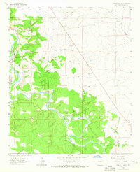
 1963 Catfish Falls1965 Print · USGSGuadalupe County ranching territory is defined by its deep river canyons and expansive land grants during the mid-twentieth century. Researchers can trace historical infrastructure from the Old Grant Railroad Grade to remote landmarks like Catfish Falls and River Ranch.
 - 1963 Map of Bar Y Ranch, 1965 Print
 1963 Bar Y Ranch1965 Print · USGSGuadalupe and San Miguel Counties were still shaped by historic land grants and remote ranching operations in the early sixties. Researchers can trace land use through landmarks like Bar Y Ranch, Cowden Ranch, and the Preston Beck Grant.2 unique versions available
 - 1963 Map of Mesita De Guadalupe, 1965 Print
 1963 Mesita De Guadalupe1965 Print · USGSGuadalupe County ranching and high-plains geography are detailed in this early 1960s survey. Researchers can trace land use through features like Moon Ranch, the Telephone Tank water source, and topographical landmarks like Entranoso Mesa.
 - 1963 Map of Anton Chico, 1966 Print
 1963 Anton Chico1966 Print · USGSTraditional New Mexican river life in the early 1960s is preserved here along the Pecos River. Trace historic irrigation systems like the Acequia de Anton Chico and locate small communities such as Tecolotito and Upper Anton Chico.
 - 1963 Map of Mesa Palo Amarillo, 1966 Print
 1963 Mesa Palo Amarillo1966 Print · USGSGuadalupe County ranching culture is documented in the 1960s across this arid plateau within the Anton Chico grant. Genealogists and historians can trace the remote Marquez Ranch and a network of water features like Streetcar Tank and Secundino Windmill.
 - 1963 Map of Mesita Del Gato, 1966 Print
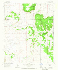 1963 Mesita Del Gato1966 Print · USGSThe ranching country on the Guadalupe and San Miguel county line comes into focus in the early sixties. Genealogists and local historians can trace family landholdings and burial sites at Monte Calvario Cem, Hage Ranch, and Boyles Cem.
Showing maps 1-25 of 405
Top cities of Guadalupe County
Frequently asked questions
- What are the different types of historical maps available for Guadalupe County?
- What is the oldest map of Guadalupe County?
- Where can I purchase historical maps of Guadalupe County for my home or office?
- Where can I download high-res historical maps of Guadalupe County?
- Are there historical topographic maps available for Guadalupe County?
- Is there historical aerial imagery available for Guadalupe County?
- Where are historical maps of Guadalupe County sourced from?