1970s Maps of Guadalupe County, New Mexico
Explore 21 historic maps of Guadalupe County from the 1970s. These maps offer a rare glimpse into what life looked like during the 1970s — showing old roads, neighborhoods, homes, and landmarks that have changed or disappeared over time.
Whether you're researching your family's past, planning a metal detecting trip, or studying how Guadalupe County's landscape evolved across the 1970s, these high-resolution maps are a powerful tool for exploring the history of this region.
- Focus on a specific era: All maps on this page are from the 1970s, giving you a focused view of this time period.
- See what’s changed: Compare century-old streets, trails, and buildings to today's modern landscape using overlays and satellite layers.
- Research with precision: Use these maps for genealogy, historical research, land use analysis, or educational projects.
- View, download, or print: Maps are fully viewable online in high resolution, and can be downloaded or printed for your own records.
Start exploring Guadalupe County's history through authentic maps from the 1970s. This is your window into the past.
Guadalupe County, NM maps
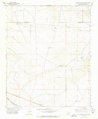
(21)- 1978 Map of Milagro Spring
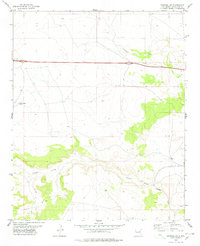
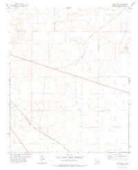
 1978 Milagro Spring1978 Print · USGSThe high plains of the Torrance and Guadalupe county line are documented here in the late seventies. Researchers can trace the essential water sources of the era, from Milagro Spring and Bales Lake to the rural Cemetery near Milagro Canyon.
 - 1978 Map of El Morro Ranch SE
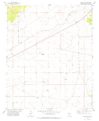
 1978 El Morro Ranch SE1978 Print · USGSThe high plains along the De Baca and Guadalupe county line are captured here in the late seventies. Family researchers and historians can trace the Atchison Topeka and Santa Fe railroad past Cardenas and locate remote ranch landmarks like Big Tank Windmill and Spring Windmill.
 - 1978 Map of George Ranch
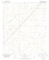
 1978 George Ranch1978 Print · USGSGuadalupe County ranchlands are captured here in the late 1970s, showcasing the remote cattle operations of the New Mexico plains. Genealogists and historians can locate family-held lands such as George Ranch and Roark Ranch near the waters of Arroyo Pintada.
 - 1978 Map of Mesa Leon
 1978 Mesa Leon1978 Print · USGSGuadalupe County ranching and rail transport are captured here during the late 1970s. Researchers can trace the Southern Pacific line past Leoncito or locate isolated livestock landmarks like Burton Windmill and Fogon Windmill.
 - 1978 Map of Tapia Ranch
 1978 Tapia Ranch1978 Print · USGSGuadalupe County ranch lands appear in the late 1970s as a landscape of dramatic mesas and deep canyons. Family-named landmarks such as Tapia Ranch and Rincon de Rosendo can be traced alongside the Southern Pacific rail line.
 - 1978 Map of Pintada
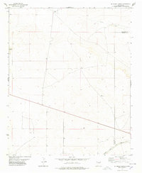
 1978 Pintada1978 Print · USGSGuadalupe County ranching lands and the high-desert terrain near Pintada are captured in the late 1970s. Researchers can trace early family sites at the Old Pintada Cem and follow the route of Interstate 40 past the York Ranch.
 - 1978 Map of Santa Barbara Lake
 1978 Santa Barbara Lake1978 Print · USGSThe high plains of eastern New Mexico are captured in the late seventies, showing a landscape of ranching and drainage basins. Researchers can trace the border between Torrance Co and Guadalupe Co near Santa Barbara Lake and Pinavete Canyon.
 - 1978 Map of Vaughn
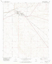 1978 Vaughn1978 Print · USGSThe railroad town of Vaughn in the late 1970s is shown at the intersection of two major western rail lines. Researchers can trace the town's development through landmarks like City Hall and Huntsinger Park, or locate family sites at Vaughn Evergreen Cem.
 - 1978 Map of Tejon
 1978 Tejon1978 Print · USGSThe high-desert border of Torrance and Guadalupe counties is captured here in the late 1970s, showcasing a landscape of critical transit infrastructure. Researchers can trace the junction of the Atchison Topeka and Santa Fe and Southern Pacific railroads near Tejon and Carnero.
 - 1978 Map of El Morro Ranch
 1978 El Morro Ranch1978 Print · USGSEastern New Mexico ranchlands are captured here in the late seventies as industrial exploration and rail transit defined the landscape. Genealogists and historians can trace the Atchison Topeka and Santa Fe line near El Morro Ranch and Sotano Blanco.
 - 1978 Map of San Ignacio
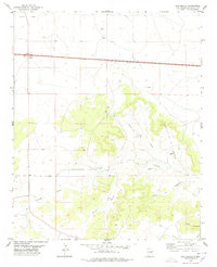 1978 San Ignacio1978 Print · USGSEastern New Mexico's ranching and mining history comes into focus in the late 1970s along the winding Arroyo Pintada. Genealogists and local historians can trace family roots at San Ignacio and its San Ignacio Cem, or locate the site of the Pintada Mine.
 - 1978 Map of Milagro
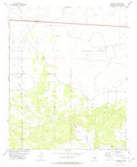 1978 Milagro1978 Print · USGSGuadalupe County land south of the Pecos River is documented here in the late seventies, showing the intersection of high-plains ranching and highway travel. Genealogists and local historians can trace the 40 and 66 corridors or locate the remote Sombrio Cem near Milagro Canyon.
 - 1978 Map of Pastura NE
 1978 Pastura NE1978 Print · USGSGuadalupe County ranching and transit are captured here in the late seventies. Family researchers and historians can trace landmarks like Moise Ranch and Middle Pasture Windmill alongside the Southern Pacific rail line.
 - 1978 Map of Laguna De Los Terreros
 1978 Laguna De Los Terreros1978 Print · USGSGuadalupe County ranching culture is documented here in the late seventies, showing a landscape shaped by water and livestock. Researchers can trace family sites like Romero and Muniz Ranch or locate isolated landmarks such as High Lonesome Windmill.
 - 1978 Map of Pastura
 1978 Pastura1978 Print · USGSPastura and the surrounding Guadalupe County ranch lands are captured in the late seventies as the railroad still dictated the pace of life. Genealogists and historians can trace the SOUTHERN PACIFIC line, the town Cem, and essential water sources like Martinez Windmill.
 - 1978 Map of El Morro Ranch NW
 1978 El Morro Ranch NW1978 Print · USGSGuadalupe County ranchlands are documented here in the late seventies, showing a landscape shaped by water and livestock. Researchers can trace the layout of the Perez Ranch and locate remote landmarks like Mc Gee Windmill and the San Pablo Draw.
 - 1978 Map of Long Draw, 1979 Print
 1978 Long Draw1979 Print · USGSGuadalupe County in the late 1970s shows a vast, open landscape defined by long-distance rail transit and natural drainages. Trace the path of the Atchison Topeka and Santa Fe railroad as it crosses the plains near Long Draw and Sotano Blanco.
 - 1978 Map of Pinavete Canyon, 1979 Print
 1978 Pinavete Canyon1979 Print · USGSThe high mesas of central New Mexico are captured here in the late seventies, showing the rugged ranching landscape at the Torrance and Guadalupe county line. Researchers can locate the settlement of Dorramadero, its local Cem, and landmarks like Armijo Peak.
 - 1978 Map of Pastura SE, 1979 Print
 1978 Pastura SE1979 Print · USGSGuadalupe County ranching and rail operations are documented here in the late seventies as the high plains economy hummed along the iron. Researchers can trace family-named landmarks and industrial sites like Histon Ranch, Arabella, and the Guadalupe Mine.
 - 1978 Map of Burro Lake, 1979 Print
 1978 Burro Lake1979 Print · USGSGuadalupe County ranch land in the late seventies is defined by isolated water sources and the diagonal line of the railroad. Researchers can trace the importance of water for livestock and transit through landmarks like Burro Lake, Twin Wells, and the Southern Pacific rail line.
 - 1979 Map of Fort Sumner
 1979 Fort Sumner1979 Print · USGSThe Pecos River valley in the late seventies reveals a landscape shaped by irrigation and the rail lines of the Atchison Topeka and Santa Fe. Genealogists and historians can trace small communities like Taiban and Yeso alongside landmarks like The Caprock.
End of results
Showing maps 1-21 of 21
Top cities of Guadalupe County
Frequently asked questions
- What are the different types of historical maps available for Guadalupe County?
- What is the oldest map of Guadalupe County?
- Where can I purchase historical maps of Guadalupe County for my home or office?
- Where can I download high-res historical maps of Guadalupe County?
- Are there historical topographic maps available for Guadalupe County?
- Is there historical aerial imagery available for Guadalupe County?
- Where are historical maps of Guadalupe County sourced from?