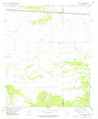
1978 Map of Milagro Spring
USGS Topo · Published 1978About this map
Milagro Spring lies at the heart of this high-plains landscape, where the boundary between Torrance County and Guadalupe County crosses the semi-arid terrain of east-central New Mexico. The geography is defined by a series of drainages and catchments essential for ranching and survival in this environment, including Encinosa Draw to the north and the prominent Milagro Canyon cutting through the center.
Find a feature on this map
17 named features on this map. Tap any name to fly to it.
Don’t see what you’re looking for? This feature index may not catch every label — zoom into the map to look around manually.
Map Details
Editions of this 1978 Milagro Spring Map
This is the sole edition of this map. No revisions or reprints were ever made.
Other maps of this area

1890 · Bernal
USGS Topo · 1:125,000

1891 · Bernal
USGS Topo · 1:125,000

1894 · Bernal
USGS Topo · 1:125,000

1954 · Santa Fe
USGS Topo · 1:250,000

1954 · Fort Sumner
USGS Topo · 1:250,000

1958 · Fort Sumner
USGS Topo · 1:250,000

1958 · Santa Fe
USGS Topo · 1:250,000

1963 · Jacinto Mesa
USGS Topo · 1:24,000
1963 · Mesa Palo Amarillo
USGS Topo · 1:24,000
1963 · Potrillo Hill
USGS Topo · 1:24,000