
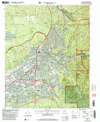
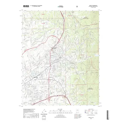
1958 Map of Santa Fe
USGS Topo · Published 1958About this map
The Sangre De Cristo Mountains dominate the western horizon of this mid-century New Mexico landscape, giving way to the high plains and mesas of the east. This 1958 survey captures the critical transportation corridors of the era, where the Atchison Topeka and Santa Fe Railway and Southern Pacific Railroad converge near the Canadian River and Pecos River drainage systems. Historic outposts like the Fort Union (Ruins) north of Watrous stand as markers of the frontier era, while the growing footprint of Santa Fe and Las Vegas reflects the state's post-war expansion.
Find a feature on this map
255 named features on this map. Tap any name to fly to it.
Don’t see what you’re looking for? This feature index may not catch every label — zoom into the map to look around manually.
Map Details
Editions of this 1958 Santa Fe Map
This is the sole edition of this map. No revisions or reprints were ever made.
Historical Maps of Santa Fe Through Time
13 maps found

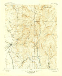
1889 Santa Fe
Santa Fe County, NM
1894 Santa Fe
Santa Fe County, NM
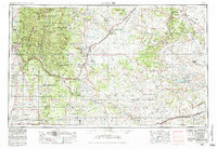
1952 Santa Fe
Santa Fe County, NM
1954 Santa Fe
Santa Fe County, NM
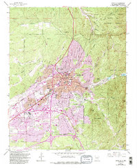
1958 Santa Fe
Santa Fe County, NM
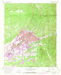
1961 Santa Fe
Santa Fe County, NM

1983 Santa Fe
Santa Fe County, NM
2002 Santa Fe
Santa Fe County, NM
2011 Santa Fe
Santa Fe County, NM
2013 Santa Fe
Santa Fe County, NM
2017 Santa Fe
Santa Fe County, NM
2020 Santa Fe
Santa Fe County, NM
2023 Santa Fe
Santa Fe County, NM