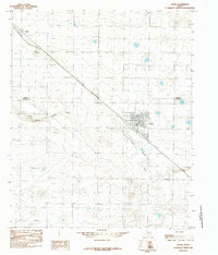
1985 Map of Anton
USGS Topo · Published 1985About this map
Anton and the surrounding plains of the Texas Panhandle are captured here during a period of established agricultural and industrial utility. The landscape is defined by a dense grid of water wells and storage tanks, reflecting the intensive irrigation required for farming in this region. This 1985 survey illustrates how the local economy integrated with transportation, showing the town of Anton situated alongside a major railway line. Further northwest, the smaller siding or loading point at Bainer serves as a secondary focal point for rural activity. The natural topography is shaped by the wide, meandering path of Yellow House Draw, which cuts across the central portion of the map. This feature is contrasted by human-engineered additions like the Sewage Disposal Ponds and a Gravel Pit, demonstrating the active management of the land for municipal and industrial needs near the Lamb Co Hockley Co border.
Find a feature on this map
6 named features on this map. Tap any name to fly to it.
Don’t see what you’re looking for? This feature index may not catch every label — zoom into the map to look around manually.
Map Details
Editions of this 1985 Anton Map
This is the sole edition of this map. No revisions or reprints were ever made.
Other maps of this area

1954 · Brownfield
USGS Topo · 1:250,000

1957 · Anton
USGS Topo · 1:62,500

1957 · Wolfforth
USGS Topo · 1:62,500

1958 · Brownfield
USGS Topo · 1:250,000

1962 · Brownfield
USGS Topo · 1:250,000

1964 · Littlefield
USGS Topo · 1:24,000

1964 · Lums Chapel
USGS Topo · 1:24,000

1964 · Whitharral
USGS Topo · 1:24,000
1976 · Anton SW
USGS Topo · 1:24,000
1976 · Wolfforth NW
USGS Topo · 1:24,000