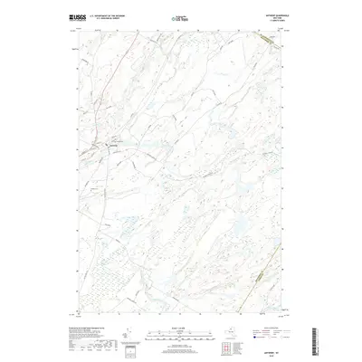
2019 Map of Antwerp
USGS Topo · Published 2019About this map
The village of Antwerp serves as the focal point of this Jefferson County landscape, where the Indian River winds through a complex terrain of ridges and wetlands. The community’s layout is defined by historic thoroughfares like Main St and Depot Rd, while the presence of Hillside Cem and the Nauvoo School Rd offer clues for genealogists and local historians tracking early settlement patterns. Much of the southern and eastern portions of the map are occupied by the Fort Drum military reservation, intersected by the Us Military Hwy. This modern survey illustrates the proximity of active military lands to quiet water bodies such as Dority Pond and the branching reaches of Rockwell Cr and Shingle Creek. The mapping of these diverse land uses shows how the modern regional economy and geography are shaped by both civil infrastructure and federal installations.
Find a feature on this map
44 named features on this map. Tap any name to fly to it.
Don’t see what you’re looking for? This feature index may not catch every label — zoom into the map to look around manually.
Map Details
Editions of this 2019 Antwerp Map
This is the sole edition of this map. No revisions or reprints were ever made.
Other maps of this area

1911 · Antwerp
USGS Topo · 1:62,500

1912 · Hammond
USGS Topo · 1:62,500

1913 · Lake Bonaparte
USGS Topo · 1:62,500

1915 · Gouverneur
USGS Topo · 1:62,500

1916 · Lake Bonaparte
USGS Topo · 1:62,500

1937 · Gouverneur
USGS Topo · 1:62,500

1944 · Hammond
USGS Topo · 1:62,500

1948 · Ogdensburg
USGS Topo · 1:250,000

1949 · Hammond
USGS Topo · 1:62,500

1949 · Antwerp
USGS Topo · 1:62,500