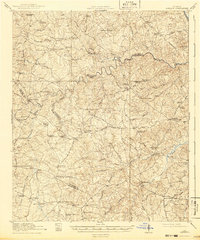
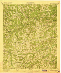
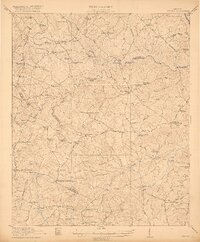
1921 Map of Appling
USGS Topo · Published 1942About this map
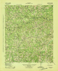
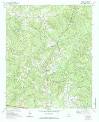
The Little River carves a winding path across this landscape, serving as a prominent boundary line between Columbia, Lincoln, and Wilkes counties. Based on surveys conducted just after World War I, the map reveals an intensely rural and communal network of early twentieth-century Georgia. Dense clusters of local institutions define the social geography, from Martins Academy and Jakes Academy in the north to the Whiteoak Camp Ground near the southern edge. This era was characterized by numerous small-scale education centers such as the Boydsville High School and China Hill School, alongside family-named landmarks like Stones Crossroads and Hogan Corner.
Find a feature on this map
89 named features on this map. Tap any name to fly to it.
Don’t see what you’re looking for? This feature index may not catch every label — zoom into the map to look around manually.
Map Details
Editions of this 1921 Appling Map
3 editions found
Historical Maps of Appling Through Time
8 maps found