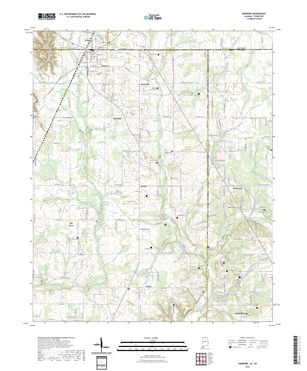
2024 Map of Ardmore
USGS Topo · Published 2024About this map
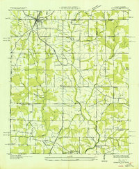
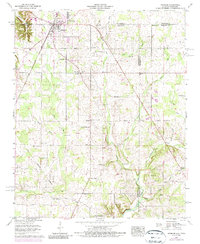
Ardmore straddles the Tennessee-Alabama border, serving as the primary hub in a region defined by agricultural heritage and small-town continuity. The landscape is carved by numerous watercourses, including Tyrone Creek, Little Limestone Creek, and Piney Creek, which drain the rolling terrain of northern Limestone Co and Madison Co. Smaller communities like Cedar Hill, Pine Dale, and Bethel appear as clusters of settlement along the local road network, while the southern edge of the quadrangle reaches into Harvest.
Find a feature on this map
123 named features on this map. Tap any name to fly to it.
Don’t see what you’re looking for? This feature index may not catch every label — zoom into the map to look around manually.
Map Details
Editions of this 2024 Ardmore Map
This is the sole edition of this map. No revisions or reprints were ever made.
Historical Maps of Cedar Hill Through Time
3 maps found