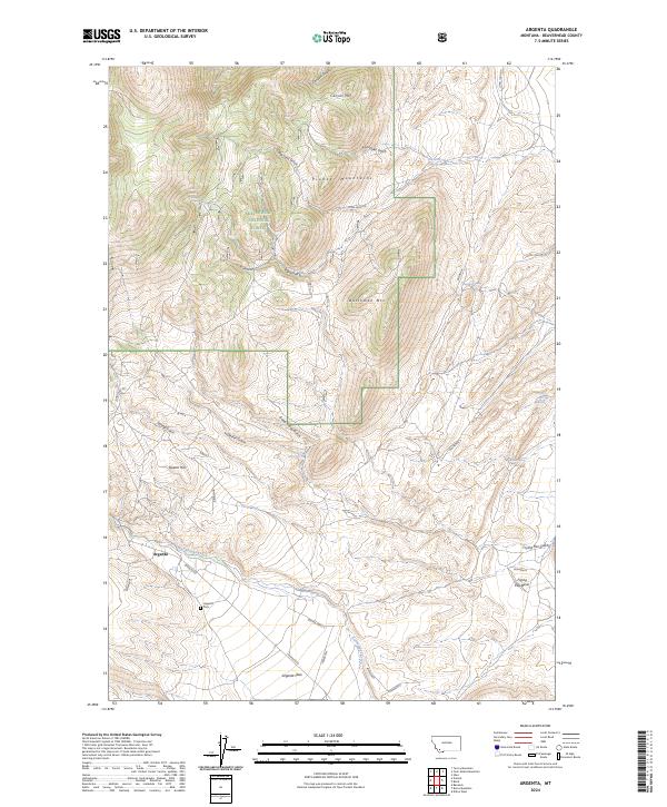
2024 Map of Argenta
USGS Topo · Published 2024About this map
Argenta sits at the southern edge of the Pioneer Mountains, where the rugged terrain of the Beaverhead National Forest meets the open Argenta Flats. The landscape is defined by a dense network of gulches and canyons, such as Canyon Gulch and Good Friday Gulch, which drain toward Rattlesnake Creek. This area's mining and prospecting heritage is reflected in landmarks like Quartz Hill and the presence of the Argenta Cem south of the main settlement. Topographic features like Canyon Mtn and Dutchman Mtn dominate the northern half of the quadrangle, while the southeast corner transitions into the Frying Pan Basin. An intricate system of mountain roads, including Long John Rd and various Bureau of Land Management routes, provides access to these high-elevation ridges and isolated springs like Dutchman Spring.
Find a feature on this map
38 named features on this map. Tap any name to fly to it.
Don’t see what you’re looking for? This feature index may not catch every label — zoom into the map to look around manually.
Map Details
Editions of this 2024 Argenta Map
This is the sole edition of this map. No revisions or reprints were ever made.
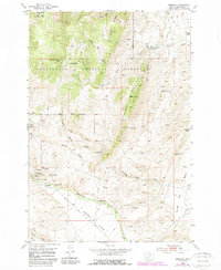
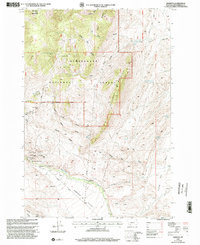
Historical Maps of Argenta Through Time
3 maps found