2022 Map of Argyle
USGS Topo · Published 2022About this map
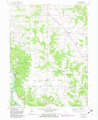
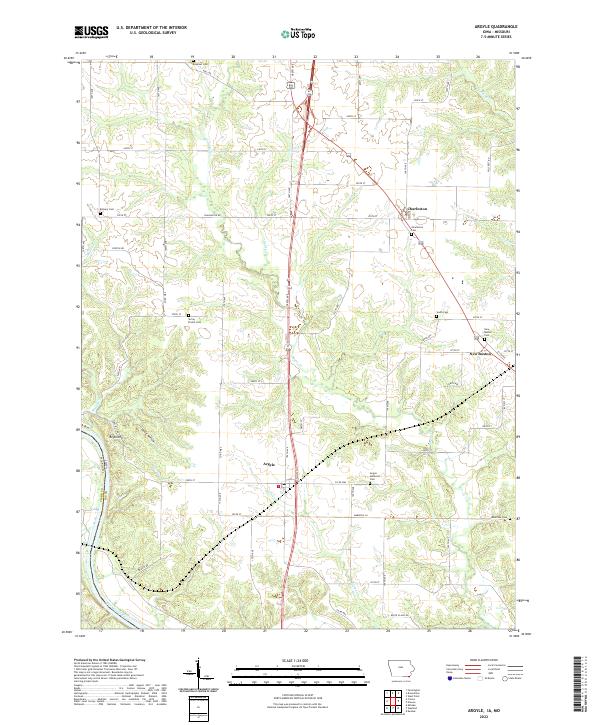
Argyle and the surrounding rural landscape of Lee County occupy this corner of southeastern Iowa, where the state border meets Missouri along the Des Moines River. The terrain is defined by a dense network of creek drainages, including Sugar Cr, Goose Cr, and Barlean Cr, which carve through the countryside toward the river valley. This modern survey captures the enduring rural footprint of the region, marked by numerous local burial grounds that reflect generations of settlement. Genealogists and local historians will find several notable sites, such as String Prairie Cem, Argyle Memorial Cem, and Bowman Cem. The map also illustrates the transition from the flat agricultural uplands to the more varied topography of Ghost Hollow and Bryan Hill in the southwest, providing a clear view of the road networks connecting Charleston and New Boston to the larger river corridor.
Find a feature on this map
47 named features on this map. Tap any name to fly to it.
Don’t see what you’re looking for? This feature index may not catch every label — zoom into the map to look around manually.
Map Details
Editions of this 2022 Argyle Map
This is the sole edition of this map. No revisions or reprints were ever made.