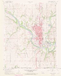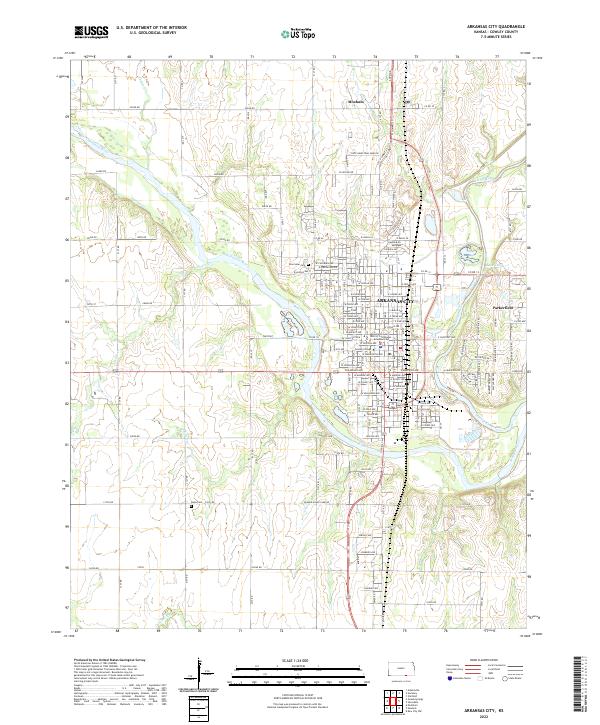
2022 Map of Arkansas City
USGS Topo · Published 2022About this map
The confluence of the Arkansas River and Walnut River dominates the geography of this southern Cowley County landscape. Arkansas City serves as the central hub, anchored by the Cowley County District Courthouse and the campus of Cowley College. The street grid expands from the city center towards the industrial activity at Goff Industrial Park Rd and the residential community of Parkerfield to the east. The terrain is defined by the winding paths of these major waterways and their tributaries, including Spring Cr and Negro Cr.
Find a feature on this map
87 named features on this map. Tap any name to fly to it.
Don’t see what you’re looking for? This feature index may not catch every label — zoom into the map to look around manually.
Map Details
Editions of this 2022 Arkansas City Map
This is the sole edition of this map. No revisions or reprints were ever made.