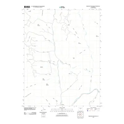
2010 Map of Arkansas Mountain
USGS Topo · Published 2010About this map
Arkansas River drainage patterns define this corridor of Fremont County, where the settlement of Cotopaxi sits at the base of a high-elevation landscape. The topography is deeply incised by numerous drainages, including Monument Creek, Bernard Creek, and Carrol Creek, which carve through a series of named peaks such as Arkansas Mountain and Garell Peak. The area's resource history is evidenced by the presence of the Cotopaxi Mine and the Indian Gulch Mine tucked away in the gulches north of the river.
Find a feature on this map
52 named features on this map. Tap any name to fly to it.
Don’t see what you’re looking for? This feature index may not catch every label — zoom into the map to look around manually.
Map Details
Editions of this 2010 Arkansas Mountain Map
This is the sole edition of this map. No revisions or reprints were ever made.
Other maps of this area

1954 · Pueblo
USGS Topo · 1:250,000

1956 · Cameron Mountain
USGS Topo · 1:62,500

1957 · Pueblo
USGS Topo · 1:250,000

1958 · Pueblo
USGS Topo · 1:250,000

1959 · Black Mountain
USGS Topo · 1:62,500

1959 · Howard
USGS Topo · 1:62,500

1959 · Cotopaxi
USGS Topo · 1:62,500

1962 · Pueblo
USGS Topo · 1:250,000

1966 · Pueblo
USGS Topo · 1:250,000
1980 · Echo
USGS Topo · 1:24,000