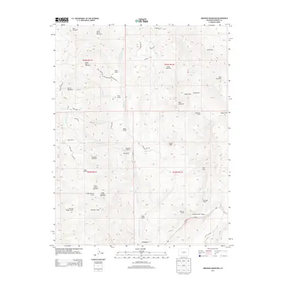
2013 Map of Arkansas Mountain
USGS Topo · Published 2013About this map
Cotopaxi serves as the primary settlement hub along the southern edge of this Fremont County landscape, situated where the Arkansas River winds through the dramatic Arkansas River Canyon. The topography is defined by a dense network of high-elevation peaks and gulches, including Arkansas Mountain and Falls Gulch Mountain. North of the river, the terrain rises into the summits of North Burno Mountain and South Burno Mountain, separated by the high-country basin of Park Gulch.
Find a feature on this map
61 named features on this map. Tap any name to fly to it.
Don’t see what you’re looking for? This feature index may not catch every label — zoom into the map to look around manually.
Map Details
Editions of this 2013 Arkansas Mountain Map
This is the sole edition of this map. No revisions or reprints were ever made.
Other maps of this area

1954 · Pueblo
USGS Topo · 1:250,000

1956 · Cameron Mountain
USGS Topo · 1:62,500

1957 · Pueblo
USGS Topo · 1:250,000

1958 · Pueblo
USGS Topo · 1:250,000

1959 · Black Mountain
USGS Topo · 1:62,500

1959 · Howard
USGS Topo · 1:62,500

1959 · Cotopaxi
USGS Topo · 1:62,500

1962 · Pueblo
USGS Topo · 1:250,000

1966 · Pueblo
USGS Topo · 1:250,000
1980 · Echo
USGS Topo · 1:24,000