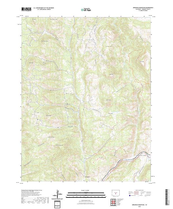
2022 Map of Arkansas Mountain
USGS Topo · Published 2022About this map
Cotopaxi serves as the focal point along the southern edge of this Fremont County landscape, situated where the Arkansas River carves through the Arkansas River Canyon. The terrain north of the river is defined by an intricate network of drainages and high points, including Arkansas Mtn, Garell Peak, and Cedar Springs Mtn. Numerous water sources such as Indian Springs and Mud Spring are scattered across the high country, indicating the essential role of hydrology in this high-altitude environment. The map details a complex system of primitive roads and trails, such as the Brigadew Springs Trl and various Bureau of Land Management routes like Blm T6051b Trl, which provide access to namesake features like Falls Gulch and Mine Gulch. The naming of Chauncy Hayden Gulch and Henthorn Gulch suggests a history of local family settlement and land use tied to the area's canyons and peaks.
Find a feature on this map
59 named features on this map. Tap any name to fly to it.
Don’t see what you’re looking for? This feature index may not catch every label — zoom into the map to look around manually.
Map Details
Editions of this 2022 Arkansas Mountain Map
This is the sole edition of this map. No revisions or reprints were ever made.
Other maps of this area

1954 · Pueblo
USGS Topo · 1:250,000

1956 · Cameron Mountain
USGS Topo · 1:62,500

1957 · Pueblo
USGS Topo · 1:250,000

1958 · Pueblo
USGS Topo · 1:250,000

1959 · Black Mountain
USGS Topo · 1:62,500

1959 · Howard
USGS Topo · 1:62,500

1959 · Cotopaxi
USGS Topo · 1:62,500

1962 · Pueblo
USGS Topo · 1:250,000

1966 · Pueblo
USGS Topo · 1:250,000
1980 · Echo
USGS Topo · 1:24,000