2022 Map of Arma
USGS Topo · Published 2022About this map
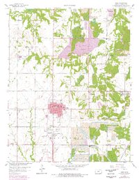
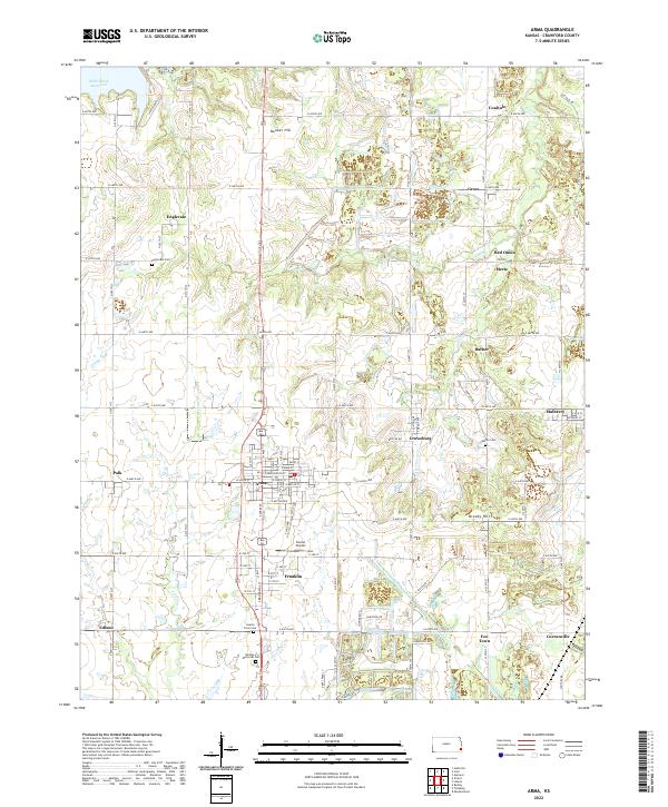
Arma and its surrounding Crawford County coal-country landscapes are preserved in this modern topographic survey, revealing a high density of small settlements that grew around the region's mining history. The map shows a transition from the structured grid of Arma and Franklin to the rural expanses of Englevale and Coalvale. Significant genealogical data is captured in the locations of several burial grounds, including the Englevale Cem, Smilie Cem, and the County Farm Cem. The terrain is marked by numerous water bodies and depressions that characterize the local geography, particularly along Cox Cr and Dry Br. To the northwest, the Bone Creek Reservoir provides a substantial water feature, while smaller landmarks like the Youvan Airport and several localized communities such as Croweburg, Breezy Hill, and Fox Town illustrate the persistent, decentralized settlement pattern of the Kansas plains.
Find a feature on this map
72 named features on this map. Tap any name to fly to it.
Don’t see what you’re looking for? This feature index may not catch every label — zoom into the map to look around manually.
Map Details
Editions of this 2022 Arma Map
This is the sole edition of this map. No revisions or reprints were ever made.