2022 Map of Arrington
USGS Topo · Published 2022About this map
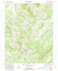
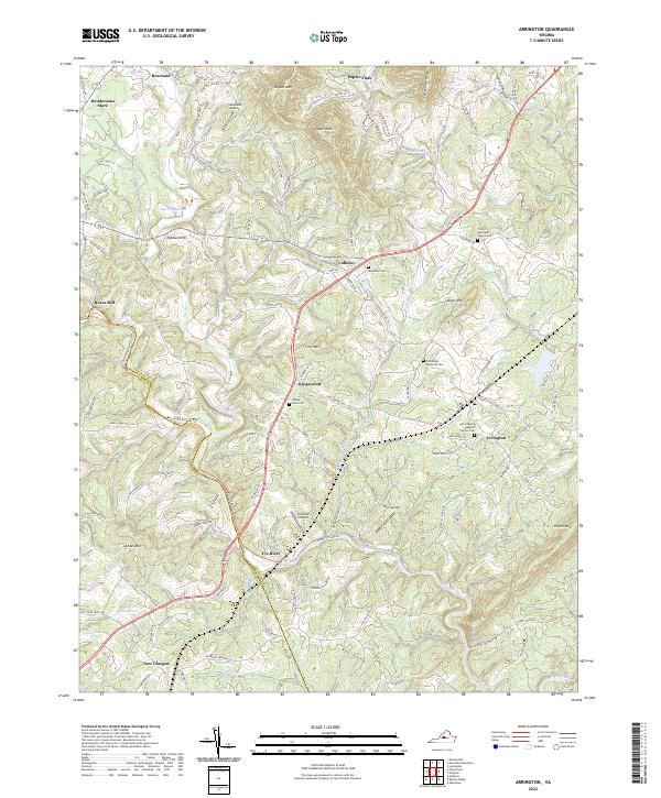
The Tye River winds through this Central Virginia landscape, anchoring a series of small rural communities and family landmarks. The settlement of Arrington serves as a local hub near the southern reaches of the map, while the terrain rises toward the north to features like Bryant Mtn and Cabell Mtn. This 2022 survey reveals a complex network of orchards and family-named roads, such as Drumheller Orchard Ln and Stevens Cove Rd, that illustrate the region's agricultural heritage. Numerous historic burial grounds dot the area, including the Woodland Cem and the Trinity Episcopal Church Cem, providing significant points of interest for genealogical research. The presence of several landing strips, such as Tye River Airport and Starr Airport, highlights how modern transportation integrates with traditional settlements like Colleen and Roseland.
Find a feature on this map
126 named features on this map. Tap any name to fly to it.
Don’t see what you’re looking for? This feature index may not catch every label — zoom into the map to look around manually.
Map Details
Editions of this 2022 Arrington Map
This is the sole edition of this map. No revisions or reprints were ever made.