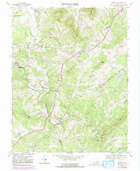
1969 Map of Arrington
USGS Topo · Published 1991About this map
The Tye River and Piney River converge in this Piedmont landscape, forming a natural boundary between Nelson Co and Amherst Co. The region's transport and industrial legacy is anchored by the Southern Railway, which connects settlements like Arrington and New Glasgow. Local life in the mid-20th century centered on dispersed rural nodes, evidenced by the high density of country churches such as Rose Union Ch and Woodland Ch.
Find a feature on this map
60 named features on this map. Tap any name to fly to it.
Don’t see what you’re looking for? This feature index may not catch every label — zoom into the map to look around manually.
Map Details
Editions of this 1969 Arrington Map
4 editions found
Other maps of this area

1892 · Buckingham
USGS Topo · 1:125,000

1894 · Lexington
USGS Topo · 1:125,000

1935 · Amherst
USGS Topo · 1:48,000

1936 · Vesuvius
USGS Topo · 1:48,000

1939 · Amherst
USGS Topo · 1:62,500

1941 · Vesuvius
USGS Topo · 1:62,500

1943 · Lovingston
USGS Topo · 1:62,500

1946 · Lovingston
USGS Topo · 1:62,500

1947 · Roanoke
USGS Topo · 1:250,000

1950 · Amherst
USGS Topo · 1:62,500