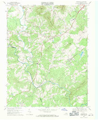
1969 Map of Arrington
USGS Topo · Published 1971About this map
The Tye River and Piney River converge in this Piedmont landscape, defining a rural economy tied to the river valleys and the Southern railroad. In the late 1960s, the area around Arrington and Colleen shows a network of family-centered landmarks and community hubs, including the County High Sch and County Jr High Sch. The map reveals a deeply etched topography where Hubbard Hill and Geddes Mtn overlook older settlements like New Glasgow and Kingswood. This era finds the region transitioning, with a Landing Strip and industrial infrastructure like a Substation and Quarries appearing alongside numerous country churches such as White Rock Ch and Little Zion Ch. The winding course of the Tye River creates a natural boundary between Nelson and Amherst counties, anchoring a terrain characterized by deep hollows like Freshwater Cove Run and Dillard Cove.
Find a feature on this map
56 named features on this map. Tap any name to fly to it.
Don’t see what you’re looking for? This feature index may not catch every label — zoom into the map to look around manually.
Map Details
Editions of this 1969 Arrington Map
4 editions found
Other maps of this area

1892 · Buckingham
USGS Topo · 1:125,000

1894 · Lexington
USGS Topo · 1:125,000

1935 · Amherst
USGS Topo · 1:48,000

1936 · Vesuvius
USGS Topo · 1:48,000

1939 · Amherst
USGS Topo · 1:62,500

1941 · Vesuvius
USGS Topo · 1:62,500

1943 · Lovingston
USGS Topo · 1:62,500

1946 · Lovingston
USGS Topo · 1:62,500

1947 · Roanoke
USGS Topo · 1:250,000

1950 · Amherst
USGS Topo · 1:62,500