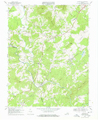
1969 Map of Arrington
USGS Topo · Published 1978About this map
Arrington serves as a focal point in the central Virginia Piedmont, situated where the Southern railroad line cuts through the undulating landscape of Nelson and Amherst counties. This 1960s-era documentation highlights a rural economy transition, where traditional settlements like Colleen and Kingswood are connected by the winding course of the Tye River and the Piney River. Significant local infrastructure is visible, including the County High Sch and County Jr High Sch, alongside numerous spiritual landmarks like White Rock Ch and New Mount Ch.
Find a feature on this map
59 named features on this map. Tap any name to fly to it.
Don’t see what you’re looking for? This feature index may not catch every label — zoom into the map to look around manually.
Map Details
Editions of this 1969 Arrington Map
4 editions found
Other maps of this area

1892 · Buckingham
USGS Topo · 1:125,000

1894 · Lexington
USGS Topo · 1:125,000

1935 · Amherst
USGS Topo · 1:48,000

1936 · Vesuvius
USGS Topo · 1:48,000

1939 · Amherst
USGS Topo · 1:62,500

1941 · Vesuvius
USGS Topo · 1:62,500

1943 · Lovingston
USGS Topo · 1:62,500

1946 · Lovingston
USGS Topo · 1:62,500

1947 · Roanoke
USGS Topo · 1:250,000

1950 · Amherst
USGS Topo · 1:62,500