
1943 Map of Lovingston
USGS Topo · Published 1961About this map
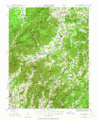
Lovingston serves as the focal point for this mid-century survey of the Virginia piedmont and mountains, where the Blue Ridge heights meet a landscape of rural hamlets and river valleys. The map documents a transition in travel through the Blue Ridge, showing the Blue Ridge Parkway following the heights while older routes like the Howardsville Turnpike and Stage Road still wind through the gaps. Settlements such as Massies Mill, Sherando, and Nellys Ford are well-established, supported by community infrastructure like Rockfish Valley High Sch and several country churches. A legacy of early industry remains visible at Orebank and Woods Mill, while the Appalachian Trail traverses the summits of Devils Knob and Three Ridges, marking the region's developing role in conservation within the George Washington National Forest.
Find a feature on this map
93 named features on this map. Tap any name to fly to it.
Don’t see what you’re looking for? This feature index may not catch every label — zoom into the map to look around manually.
Map Details
Editions of this 1943 Lovingston Map
2 editions found
Other maps of this area

1892 · Buckingham
USGS Topo · 1:125,000

1892 · Harrisonburg
USGS Topo · 1:125,000

1894 · Staunton
USGS Topo · 1:125,000

1894 · Lexington
USGS Topo · 1:125,000

1929 · Covesville
USGS Topo · 1:62,500

1931 · University
USGS Topo · 1:62,500

1934 · Waynesboro
USGS Topo · 1:48,000

1935 · Amherst
USGS Topo · 1:48,000

1935 · Covesville
USGS Topo · 1:62,500

1935 · University
USGS Topo · 1:62,500