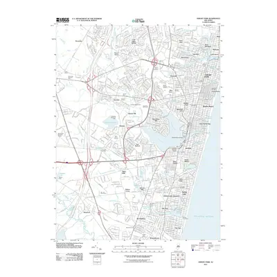
2011 Map of Asbury Park
USGS Topo · Published 2011About this map
The Atlantic shoreline of Monmouth County is defined by a series of coastal lakes and boroughs in this 2011 survey. From Asbury Park south to Belmar, the landscape is densely partitioned into historic seaside communities like Ocean Grove and Bradley Beach. The geography here is unique for its coastal freshwater bodies, including Deal Lake, Sunset Lake, and Wreck Pond, which sit just behind the oceanfront.
Find a feature on this map
84 named features on this map. Tap any name to fly to it.
Don’t see what you’re looking for? This feature index may not catch every label — zoom into the map to look around manually.
Map Details
Editions of this 2011 Asbury Park Map
This is the sole edition of this map. No revisions or reprints were ever made.
Other maps of this area

1888 · Asbury Park
USGS Topo · 1:62,500

1888 · Sandy Hook
USGS Topo · 1:62,500

1893 · Sandy Hook
USGS Topo · 1:62,500

1893 · Asbury Park
USGS Topo · 1:62,500

1901 · Sandy Hook
USGS Topo · 1:62,500

1901 · Asbury Park
USGS Topo · 1:62,500

1902 · Navesink
USGS Topo · 1:125,000

1918 · Sandy Hook
USGS Topo · 1:62,500

1919 · Asbury Park
USGS Topo · 1:62,500

1942 · Farmingdale
USGS Topo · 1:24,000