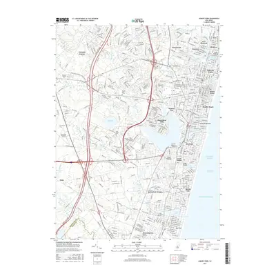
2016 Map of Asbury Park
USGS Topo · Published 2016About this map
Asbury Park and its surrounding coastal communities sit at the center of this 2016 topographical study, illustrating the dense suburban development and complex water systems of the New Jersey shore. The landscape is defined by a series of coastal lakes and ponds, including Deal Lake, Sunset Lake, and Wesley Lake, which separate historic boroughs like Allenhurst and Ocean Grove. The inland areas show the significant footprint of the Glendola Reservoir and the Monmouth Executive Airport, contrasted with the managed green spaces of Saint Anne's Cem and Mount Calvary Cem.
Find a feature on this map
58 named features on this map. Tap any name to fly to it.
Don’t see what you’re looking for? This feature index may not catch every label — zoom into the map to look around manually.
Map Details
Editions of this 2016 Asbury Park Map
This is the sole edition of this map. No revisions or reprints were ever made.
Other maps of this area

1888 · Asbury Park
USGS Topo · 1:62,500

1888 · Sandy Hook
USGS Topo · 1:62,500

1893 · Sandy Hook
USGS Topo · 1:62,500

1893 · Asbury Park
USGS Topo · 1:62,500

1901 · Sandy Hook
USGS Topo · 1:62,500

1901 · Asbury Park
USGS Topo · 1:62,500

1902 · Navesink
USGS Topo · 1:125,000

1918 · Sandy Hook
USGS Topo · 1:62,500

1919 · Asbury Park
USGS Topo · 1:62,500

1942 · Farmingdale
USGS Topo · 1:24,000