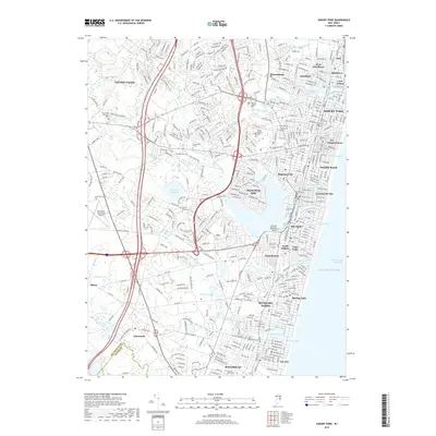
2019 Map of Asbury Park
USGS Topo · Published 2019About this map
The Atlantic coast of New Jersey is defined here by its dense chain of beach communities and intricate coastal lagoons. From Asbury Park south to Manasquan, the landscape is a continuous stretch of borough and city grids, separated by small lakes such as Sylvan Lake, Silver Lake, and Wreck Pond. Inland, the Garden State Parkway and the New Jersey Transit rail line facilitate the flow of residents and travelers, while the Shark River widens into a significant basin near Shark River Hills.
Find a feature on this map
67 named features on this map. Tap any name to fly to it.
Don’t see what you’re looking for? This feature index may not catch every label — zoom into the map to look around manually.
Map Details
Editions of this 2019 Asbury Park Map
This is the sole edition of this map. No revisions or reprints were ever made.
Other maps of this area

1888 · Asbury Park
USGS Topo · 1:62,500

1888 · Sandy Hook
USGS Topo · 1:62,500

1893 · Sandy Hook
USGS Topo · 1:62,500

1893 · Asbury Park
USGS Topo · 1:62,500

1901 · Sandy Hook
USGS Topo · 1:62,500

1901 · Asbury Park
USGS Topo · 1:62,500

1902 · Navesink
USGS Topo · 1:125,000

1918 · Sandy Hook
USGS Topo · 1:62,500

1919 · Asbury Park
USGS Topo · 1:62,500

1942 · Farmingdale
USGS Topo · 1:24,000