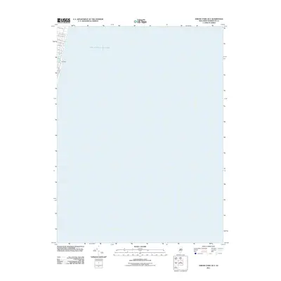
2011 Map of Asbury Park OE E
USGS Topo · Published 2011About this map
The Atlantic Ocean dominates this offshore survey, capturing the thin coastal edge of Monmouth County as it appeared in the early 21st century. The map focuses on the interface between the sea and the residential grid of the shoreline, where Deal Lake is regulated by the Deal Dam. This specific geography highlights the developed beachfront, including the iconic Boardwalk and a network of street names like Deal Esplanade and Monmouth Dr that define the local neighborhoods. Because most of the area shown is open water, the map provides an unusually clear view of the exact bathymetry and nautical positioning of the Jersey Shore's coastline relative to its street-level infrastructure.
Find a feature on this map
13 named features on this map. Tap any name to fly to it.
Don’t see what you’re looking for? This feature index may not catch every label — zoom into the map to look around manually.
Map Details
Editions of this 2011 Asbury Park OE E Map
This is the sole edition of this map. No revisions or reprints were ever made.
Other maps of this area

1888 · Asbury Park
USGS Topo · 1:62,500

1888 · Sandy Hook
USGS Topo · 1:62,500

1893 · Sandy Hook
USGS Topo · 1:62,500

1893 · Asbury Park
USGS Topo · 1:62,500

1901 · Sandy Hook
USGS Topo · 1:62,500

1901 · Asbury Park
USGS Topo · 1:62,500

1902 · Navesink
USGS Topo · 1:125,000

1918 · Sandy Hook
USGS Topo · 1:62,500

1919 · Asbury Park
USGS Topo · 1:62,500

1944 · Newark
USGS Topo · 1:250,000