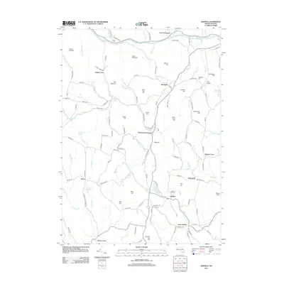
2012 Map of Ashfield
USGS Topo · Published 2012About this map
The Deerfield River forms the northern boundary of this western Massachusetts landscape, where the settlements of Buckland and Ashfield anchor a network of rural roads and upland streams. The terrain is defined by numerous peaks and ridges, including Mary Lyon Hill, Snow Mountain, and Seventy Six Hill, which overlook a series of small, dispersed communities. Smaller hamlets like Baptist Corner, Spruce Corner, and Beldingville illustrate the historic settlement pattern of the region. Genealogists and local historians can trace several burial sites throughout the township, including the Ashfield Plain Cem, Hill Cem, and Leavitt Cem. Water resources are prominent throughout, with the S River and Clesson Brook winding through the valleys, supported by the Upper Reservoir and Hillman Ice Pond.
Find a feature on this map
124 named features on this map. Tap any name to fly to it.
Don’t see what you’re looking for? This feature index may not catch every label — zoom into the map to look around manually.
Map Details
Editions of this 2012 Ashfield Map
This is the sole edition of this map. No revisions or reprints were ever made.
Other maps of this area

1885 · Northampton
USGS Topo · 1:62,500

1886 · Hawley
USGS Topo · 1:62,500

1886 · Chesterfield
USGS Topo · 1:62,500

1886 · Northampton
USGS Topo · 1:62,500

1888 · Chesterfield
USGS Topo · 1:62,500

1890 · Hawley
USGS Topo · 1:62,500

1890 · Greenfield
USGS Topo · 1:62,500

1891 · Northampton
USGS Topo · 1:62,500

1893 · Northampton
USGS Topo · 1:62,500

1893 · Chesterfield
USGS Topo · 1:62,500