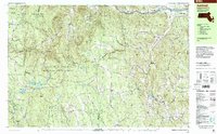
1998 Map of Ashfield
USGS Topo · Published 2000About this map
The hills of Franklin County are characterized by steep elevations and dense woodlands, dominated by the Kenneth M Dubuque Memorial State Forest and portions of the Mohawk Trail State Forest. Small settlements like West Hawley, Plainfield, and Baptist Corner anchor the rural landscape, connected by winding routes like the famous Mohawk Trail. Water resources are abundant, ranging from the Deerfield River in the north to high-country basins such as Plainfield Pond and Ashfield Pond. Local history is preserved in numerous family and community burial grounds, including the Pudding Hollow and Bozrah cemeteries. The map illustrates a late 20th-century view of these highland towns where institutional landmarks like Sanderson Academy and Mohawk Trail Regional High School serve a widely dispersed population amidst the protected forest reserves.
Find a feature on this map
100 named features on this map. Tap any name to fly to it.
Don’t see what you’re looking for? This feature index may not catch every label — zoom into the map to look around manually.
Map Details
Editions of this 1998 Ashfield Map
This is the sole edition of this map. No revisions or reprints were ever made.
Other maps of this area

1885 · Northampton
USGS Topo · 1:62,500

1886 · Greylock
USGS Topo · 1:62,500

1886 · Hawley
USGS Topo · 1:62,500

1886 · Chesterfield
USGS Topo · 1:62,500

1886 · Northampton
USGS Topo · 1:62,500

1886 · Becket
USGS Topo · 1:62,500

1888 · Becket
USGS Topo · 1:62,500

1888 · Chesterfield
USGS Topo · 1:62,500

1890 · Hawley
USGS Topo · 1:62,500

1890 · Greenfield
USGS Topo · 1:62,500