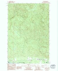
2023 Map of Ashford
USGS Topo · Published 2023About this map
Ashford and the nearby settlement of National sit along the northern banks of the Nisqually River in this detailed survey of southern Pierce County. The landscape is dominated by the southwestern boundary of Mount Rainier National Park and the complex drainage systems of the Mashel River and Busy Wild Creek. The topography rises toward The Divide in the north, while local life centers on the corridors of Mount Tahoma Canyon Rd and Eatonville National Rd. The map illustrates a contemporary view of this gateway region, where the commercial activity of the small settlements meets the protected wilderness of the national park. Numerous smaller waterways, including Niesson Creek, Big Creek, and Beaver Creek, carve through the timbered sections between the Pierce Co Lewis Co boundary and the high ridges to the north.
Find a feature on this map
22 named features on this map. Tap any name to fly to it.
Don’t see what you’re looking for? This feature index may not catch every label — zoom into the map to look around manually.
Map Details
Editions of this 2023 Ashford Map
This is the sole edition of this map. No revisions or reprints were ever made.