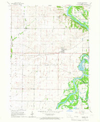
1965 Map of Atalissa
USGS Topo · Published 1966About this map
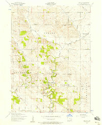
The town of Atalissa anchors this mid-1960s landscape, situated along the Chicago, Rock Island and Pacific railroad line. The terrain is defined by the meandering path of the Cedar River and its intricate network of tributaries and artificial drainage. Extensive wetlands and managed conservation lands dominate the eastern portion of the map, notably the Wiese Slough State Game Management Area and the namesake Wiese Slough.
Find a feature on this map
27 named features on this map. Tap any name to fly to it.
Don’t see what you’re looking for? This feature index may not catch every label — zoom into the map to look around manually.
Map Details
Editions of this 1965 Atalissa Map
This is the sole edition of this map. No revisions or reprints were ever made.
Other maps of this area

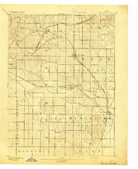
1891 · Wilton Junction
USGS Topo · 1:62,500
1894 · West Liberty
USGS Topo · 1:62,500

1901 · Stanwood
USGS Topo · 1:125,000

1948 · Muscatine
USGS Topo · 1:62,500
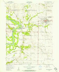
1953 · Wilton Junction
USGS Topo · 1:24,000
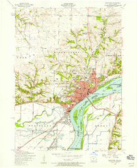
1953 · Muscatine
USGS Topo · 1:24,000
1953 · Lime City
USGS Topo · 1:24,000

1958 · Davenport
USGS Topo · 1:250,000

1961 · Davenport
USGS Topo · 1:250,000

1962 · Davenport
USGS Topo · 1:250,000