2022 Map of Atkins
USGS Topo · Published 2022About this map
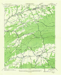
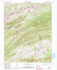
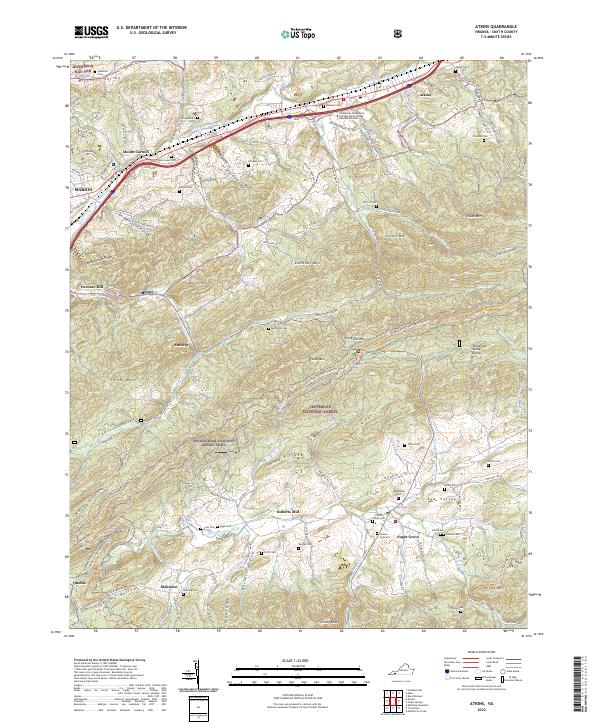
Atkins and Mount Carmel anchor the northern landscape of this Smyth County study, where the Middle Fork Holston River winds through Mitchell Valley alongside the Wytheville Community College-Smyth County Education Center. The terrain is defined by the high ridges of the Jefferson National Forest, including Chestnut Mtn and Brushy Mtn, which separate the northern river valley from the southern reaches of Rye Valley. Numerous family-named cemeteries such as Hutton - Cox Cem, James Family Cem, and McGhee Cem are scattered throughout the hollows, indicating long-standing settlement patterns in the gaps of Sheep Ridge and Hickory Ridge.
Find a feature on this map
75 named features on this map. Tap any name to fly to it.
Don’t see what you’re looking for? This feature index may not catch every label — zoom into the map to look around manually.
Map Details
Editions of this 2022 Atkins Map
This is the sole edition of this map. No revisions or reprints were ever made.