Old Maps of Smyth County, Virginia
Explore 148 old maps of Smyth County, spanning from 1887 to today. These high-resolution historic maps reveal how streets, neighborhoods, landmarks, and natural features evolved over time — perfect for genealogy, metal detecting, research, and local history exploration.
What you can do with these maps:
- See how Smyth County changed over time: Compare historical maps to modern-day views to trace roads, homesites, rail lines & more.
- View detailed metadata: Each map includes creators, publishers, year, scale, and archive source.
- Overlay maps with satellite & LiDAR: Visualize the past alongside modern tools to explore terrain & human change.
- Trusted historical sources: Maps sourced from the USGS, Library of Congress, and other archives.
- Access maps your way: View online, download high-res files, or order prints for personal or research use.
Start exploring old maps of Smyth County to uncover forgotten places, hidden landmarks, and the deep history beneath your feet.
Smyth County, VA maps
(148)- 1887 Map of Pocahontas
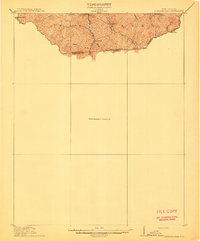
 1887 Pocahontas1887 Print · USGSThe Virginia and West Virginia borderlands are shown here in the 1880s as the coal industry and railroads began to reshape the Appalachian ridges. Genealogists can locate early settlements and landmarks like Seddon (Bland C. H.), the valley at Burks Garden, and the Concord Church congregation.
 - 1889 Map of Wytheville
 1889 Wytheville1889 Print · USGSSouthwestern Virginia and northwestern North Carolina are mapped here during the late nineteenth-century rise of the mountain iron industry. Genealogists and historians can locate early post offices and industrial sites such as Bridle Creek P.O., Eagle Furnace, and Rural Retreat.2 unique versions available
 - 1891 Map of Tazewell
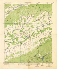
 1891 Tazewell1891 Print · USGSThe Clinch Valley highlands are shown here in the late nineteenth century, capturing the early settlement of the Virginia and West Virginia borderlands. Local historians can trace the foundations of Jeffersonville and rural outposts like Baptist Valley and Cedar Bluff.
 - 1891 Map of Pocahontas
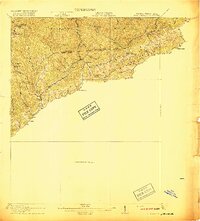
 1891 Pocahontas1891 Print · USGSThe Virginia and West Virginia borderlands are captured here during the late nineteenth-century expansion of the coal and rail industries. Genealogists and researchers can locate early settlements like Sedon (Bland CH), Spanishburg, and Pocahontas along the newly laid Norfolk and Western Railroad.
 - 1891 Map of Abingdon
 1891 Abingdon1891 Print · USGSSouthwest Virginia in the 1890s reveals a landscape of mountain ridges and thriving valley settlements along the Norfolk and Western R. R. Lineages can be traced through sites like Emory and Henry College, Saltville, and numerous family-named landmarks like Vance's Mill.
 - 1892 Map of Wytheville, 1897 Print
 1892 Wytheville1897 Print · USGSThe high ridges and river valleys of Southwest Virginia and Northwest North Carolina are captured here in the late nineteenth century. Genealogists can trace family footprints across the Iron Mountains to old industrial sites like White Rock Furnace and remote post offices such as Hampton P.O.6 unique versions available
 - 1894 Map of Pocahontas
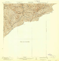
 1894 Pocahontas1894 Print · USGSThe Virginia and West Virginia borderlands are shown here during the late nineteenth-century coal boom. Researchers can trace early railroad expansion through settlements like Pocahontas or locate family roots in mountain basins such as Burke Garden and Sed Don.
 - 1894 Map of Abingdon, 1896 Print
 1894 Abingdon1896 Print · USGSSouthwest Virginia's valley and ridge country is captured here during the peak of the rail era, centered on the Abingdon and Marion corridors. Local historians can trace the foundations of Emory and Henry College and numerous rural mill sites like Belfast Mills or Vance's Mill.5 unique versions available
 - 1895 Map of Tazewell
 1895 Tazewell1895 Print · USGSSouthwest Virginia and the West Virginia coalfields are captured in the 1890s as the rail network transformed these mountain valleys. Researchers can trace early settlements and stores along the Norfolk and Western RR, from Tazewell to the mines near Welch and Vivian.
 - 1895 Map of Pocahontas
 1895 Pocahontas1895 Print · USGSCoal mining towns and the Norfolk and Western RR line the border of Virginia and West Virginia in the late nineteenth century. Genealogists can trace the early layouts of Pocahontas, Bluefield, and the unusual enclosed valley of Burke Garden.6 unique versions available
 - 1897 Map of Tazewell
 1897 Tazewell1897 Print · USGSThe rugged coal and timber lands of the border country appear here in the 1890s as the rail network expands. Genealogists can trace family roots at Mc Neil Store, follow the early growth of Welch, and locate homesteads near Shack Mills.8 unique versions available
 - 1909 Map of Abingdon
 1909 Abingdon1909 Print · USGSSouthwest Virginia at the first decade's end shows a valley landscape defined by the iron rail and steep ridges. Genealogists and historians can trace the early layouts of Abingdon and Glade Spring, or locate landmarks like Dove Mills and the County Farm.2 unique versions available
 - 1911 Map of Abingdon
 1911 Abingdon1911 Print · USGSSouthwest Virginia's rugged corridors are captured here during the height of the mountain rail era. Genealogists and historians can trace old homesteads and local landmarks such as Whites Mill, Valley Church, and the County Farm near Abingdon.5 unique versions available
 - 1912 Map of Pounding Mill
 1912 Pounding Mill1912 Print · USGSThe McDowell and Tazewell borderlands appear here in the decade before the First World War, showing the early infrastructure of this mountainous region. Researchers can trace the path of Squire Jim Road and locate the settlement of Horsepen among the headwaters of Big Creek.
 - 1916 Map of Pounding Mill
 1916 Pounding Mill1916 Print · USGSThe Virginia and West Virginia state line was a rugged landscape of isolated mountain hollows and ridge-top knobs during the early twentieth century. Genealogists can trace family footprints near Greasy Creek School, the NORFOLK AND WESTERN RR, and the settlement of Sayersville.
 - 1926 Map of Pounding Mill
 1926 Pounding Mill1926 Print · USGSAppalachian mountain life near the state line in the mid-twenties centers on remote hollows and high ridges. Researchers can trace the Norfolk and Western RR through Bandy or find family landmarks like the George Camp School and Sayersville.2 unique versions available
 - 1931 Map of Rural Retreat
 1931 Rural Retreat1931 Print · USGSSouthwestern Virginia in the early 1930s is defined by its ridge-and-valley terrain and the rail-and-road corridor of the Norfolk and Western. Genealogists can trace local landmarks like Wasson Cem, Roberts Mill, and the Old Iron Mine near Sugar Grove.
 - 1934 Map of Chatham Hill
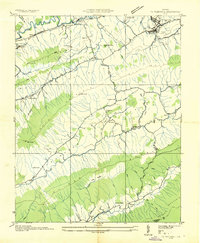
 1934 Chatham Hill1934 Print · USGSSmyth County's river valleys and ridgelines are captured here in the mid-1930s during the early development of the regional park system. Researchers can locate vanished landmarks like New Cove Sch, the site of the Proposed Hungry Mother Lake, and the crossing at Ellendale Ford.
 - 1934 Map of Tazewell
 1934 Tazewell1934 Print · USGSThe Clinch River headwaters and Appalachian ridges of Tazewell County are captured here in the mid-1930s. Researchers can trace the Norfolk and Western railroad through Maxwell or locate country landmarks like Creagers Mill and the Tazewell County Fair Grounds.
 - 1935 Map of Konnarock
 1935 Konnarock1935 Print · USGSThe mountains of Southwest Virginia come alive in the mid-1930s, showing the early reach of the Unaka National Forest. Local researchers can trace family roots through sites like Konnarock, Loves Mill, and several rural schoolhouses like Piedmont Sch.
 - 1935 Map of Chilhowie
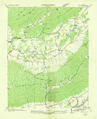
 1935 Chilhowie1935 Print · USGSSmyth County was a center of mountain industry and valley farming in the mid-1930s, defined by the Holston River forks. Researchers can trace historic family landmarks from Mathieson Alkali Works to rural centers like St Clair Bottom and Carlock Ch.
 - 1935 Map of Nebo
 1935 Nebo1935 Print · USGSSmyth County mountain valleys and the Holston River are mapped here in the mid-1930s. Genealogists can locate family landmarks like Tilson Mill, Groseclose Store, and rural schoolhouses including Nebo Sch.
 - 1935 Map of Maccrady
 1935 Maccrady1935 Print · USGSSmyth and Tazewell Counties are shown here during the mid-1930s, as industrial activity along the river defined the local economy. Researchers can trace the path of the Mathieson Alkali Works R. R. and locate family landmarks like Carter Sch or Watsons Gap Sch.
 - 1935 Map of Mouth of Wilson
 1935 Mouth of Wilson1935 Print · USGSGrayson County was a landscape of high ridges and river crossings in the mid-1930s. Researchers can trace family sites at Youngs Chapel, find early crossings like Halsey Ferry, and locate old mountain schoolhouses like Oak Hill Sch and Fairwood Sch.
 - 1935 Map of Mount Rogers
 1935 Mount Rogers1935 Print · USGSThe high peaks of Grayson and Smyth Counties are documented here in the mid-1930s as the Appalachian Trail was being established across Mount Rogers. Genealogists and historians can trace the foundations of mountain life at Konnarock, the Iron Mountain Boys Sch, and Taylors Valley.
Showing maps 1-25 of 148
Top cities of Smyth County
Frequently asked questions
- What are the different types of historical maps available for Smyth County?
- What is the oldest map of Smyth County?
- Where can I purchase historical maps of Smyth County for my home or office?
- Where can I download high-res historical maps of Smyth County?
- Are there historical topographic maps available for Smyth County?
- Is there historical aerial imagery available for Smyth County?
- Where are historical maps of Smyth County sourced from?