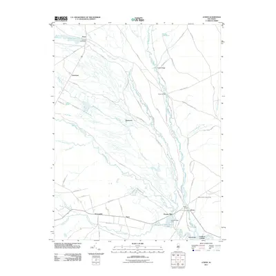
2011 Map of Atsion
USGS Topo · Published 2011About this map
Pleasant Mills and Batsto stand as central points in this landscape defined by the intricate convergence of the Mullica River, Batsto River, and Nescochague Creek. The area is marked by water management and early industrial sites, including the Pleasant Mills Dam and Atsion Lake Dam. These settlements and crossings like Quaker Bridge and Lower Forge reflect the historical movement through the pine forests of Atlantic and Burlington counties. Further south, the landscape shifts toward the small communities of Sweetwater and Nesco, where Hammonton Creek flows toward the tidewaters. Navigational landmarks such as the Batsto Forestry Lookout Tower and Gardiners Landing highlight the region's reliance on both forest management and river access.
Find a feature on this map
68 named features on this map. Tap any name to fly to it.
Don’t see what you’re looking for? This feature index may not catch every label — zoom into the map to look around manually.
Map Details
Editions of this 2011 Atsion Map
This is the sole edition of this map. No revisions or reprints were ever made.
Other maps of this area

1888 · Pemberton
USGS Topo · 1:62,500

1888 · Mount Holly
USGS Topo · 1:62,500

1890 · Hammonton
USGS Topo · 1:62,500

1890 · Mullica
USGS Topo · 1:62,500

1894 · Hammonton
USGS Topo · 1:62,500

1894 · Pemberton
USGS Topo · 1:62,500

1894 · Mount Holly
USGS Topo · 1:62,500

1894 · Mullica
USGS Topo · 1:62,500

1898 · Pemberton
USGS Topo · 1:62,500

1898 · Mount Holly
USGS Topo · 1:62,500