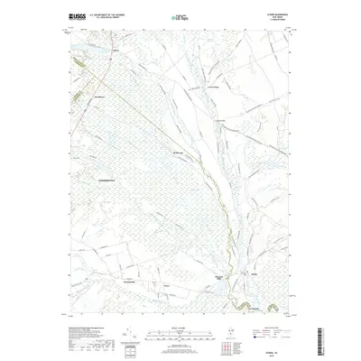
2019 Map of Atsion
USGS Topo · Published 2019About this map
The Mullica River and Batsto River converge within a landscape dominated by the extensive Great Swamp, a region where the pine barrens of Burlington and Atlantic counties meet. This 2019 survey captures a network of historical settlements and transit routes that evolved from early industrial sites. The settlement of Batsto remains a focal point near the southern boundary, while the site of Pleasant Mills sits at the junction of Nescochague Creek and the Mullica. To the north, Atsion and Atsion Lake mark the entry into these wetlands. The terrain is crisscrossed by specialized trails and tracks including the Batona Trl, the Washington Quaker Bridge Road, and the Penn Branch Trail, reflecting the area's history of resource extraction and passage through the dense interior.
Find a feature on this map
97 named features on this map. Tap any name to fly to it.
Don’t see what you’re looking for? This feature index may not catch every label — zoom into the map to look around manually.
Map Details
Editions of this 2019 Atsion Map
This is the sole edition of this map. No revisions or reprints were ever made.
Other maps of this area

1888 · Pemberton
USGS Topo · 1:62,500

1888 · Mount Holly
USGS Topo · 1:62,500

1890 · Hammonton
USGS Topo · 1:62,500

1890 · Mullica
USGS Topo · 1:62,500

1894 · Hammonton
USGS Topo · 1:62,500

1894 · Pemberton
USGS Topo · 1:62,500

1894 · Mount Holly
USGS Topo · 1:62,500

1894 · Mullica
USGS Topo · 1:62,500

1898 · Pemberton
USGS Topo · 1:62,500

1898 · Mount Holly
USGS Topo · 1:62,500