2022 Map of Auburn
USGS Topo · Published 2022About this map
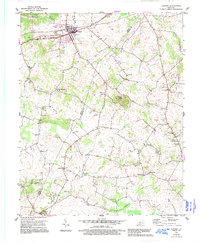
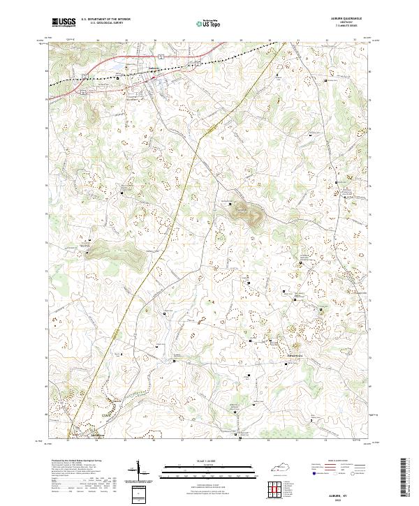
Auburn stands as the primary hub of this landscape, situated near the headwaters of Black Lick Cr where the local road network converges. The terrain is characterized by isolated rises like Pilot Knob and Prospect Hill, which provide relief in a region dominated by agricultural patterns and dispersed rural settlements. Evidence of the area's deep-rooted community ties is visible through the high density of small cemeteries and churches that dot the countryside, including the Providence Mennonite Fellowship Cem and the Franklin Mennonite Cem. These features, along with names like Turnertown and Middleton, trace the enduring social geography of south-central Kentucky. The boundary between Logan Co and Simpson Co bisects the area, influencing the local infrastructure and land divisions that have shaped these farming communities for generations.
Find a feature on this map
122 named features on this map. Tap any name to fly to it.
Don’t see what you’re looking for? This feature index may not catch every label — zoom into the map to look around manually.
Map Details
Editions of this 2022 Auburn Map
This is the sole edition of this map. No revisions or reprints were ever made.