Old Maps of Logan County, Kentucky
Explore 122 old maps of Logan County, spanning from 1911 to today. These high-resolution historic maps reveal how streets, neighborhoods, landmarks, and natural features evolved over time — perfect for genealogy, metal detecting, research, and local history exploration.
What you can do with these maps:
- See how Logan County changed over time: Compare historical maps to modern-day views to trace roads, homesites, rail lines & more.
- View detailed metadata: Each map includes creators, publishers, year, scale, and archive source.
- Overlay maps with satellite & LiDAR: Visualize the past alongside modern tools to explore terrain & human change.
- Trusted historical sources: Maps sourced from the USGS, Library of Congress, and other archives.
- Access maps your way: View online, download high-res files, or order prints for personal or research use.
Start exploring old maps of Logan County to uncover forgotten places, hidden landmarks, and the deep history beneath your feet.
Logan County, KY maps
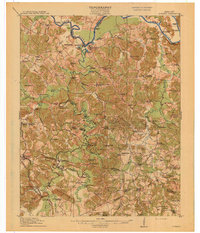
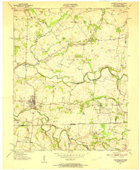
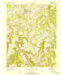
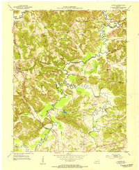
(122)- 1911 Map of Drakesboro
 1911 Drakesboro1911 Print · USGSMuhlenberg County was a landscape of dense rural school districts and emerging rail towns just before the Great War. Genealogists can trace family names through landmarks like Mays Store, Rhodes Chapel, and the uniquely named settlement of Lickskillet.
 - 1911 Map of Dunmor
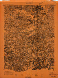
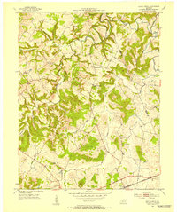
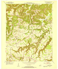
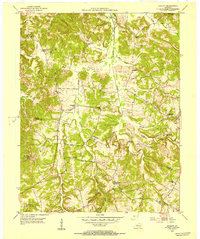
 1911 Dunmor1911 Print · USGSMuhlenberg and Butler Counties are shown here just before the Great War, when river ferries and small rural schools anchored local life. Genealogists can trace family footprints at Mining City, Ebenezer Church, and the river landings near Skilesville.
 - 1913 Map of Drakesboro
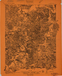
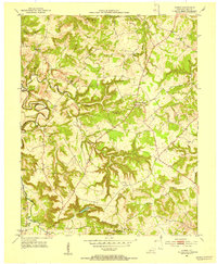
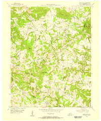
 1913 Drakesboro1913 Print · USGSMuhlenberg County in the early twentieth century was a bustling intersection of coal mining and major rail lines. Genealogists and historians can trace dozens of early rural schools and crossroads stores like Liberty Hill School, Belton Jost PO, and Dixon's Store.2 unique versions available
 - 1914 Map of Little Muddy
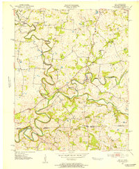
 1914 Little Muddy1914 Print · USGSThe river-driven economy of Butler and Warren Counties is captured here in the years before widespread bridge construction. Genealogists can locate family-named landmarks and rural hubs like Morgantown, Stevenson Chapel, and crossings at Doctors Ford.4 unique versions available
 - 1914 Map of Dunmor
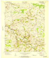
 1914 Dunmor1914 Print · USGSWestern Kentucky in the early twentieth century is defined by the river-borne trade of the Green River and the rural industry of the Mud River Mine. Genealogists and historians can trace defunct post offices like Boston Herschel PO and family-named crossings including Arnolds Bridge and Doolins Ferry.
 - 1942 Map of Gallatin
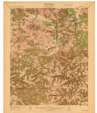
 1942 Gallatin1942 Print · USGSThe Tennessee-Kentucky borderlands were a crossroads of river and rail during the early war years. Genealogists and historians can trace family roots through dozens of named settlements like Bethpage, Prices Mill, and Mitchellville, or locate historic river crossings such as Kirkpatricks Ferry.
 - 1950 Map of Allensville, 1952 Print
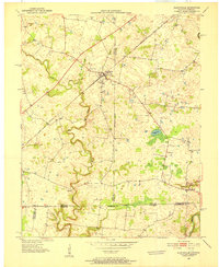 1950 Allensville1952 Print · USGSSpanning the Kentucky and Tennessee border in the early 1950s, this area centers on the vital Louisville and Nashville rail line. Researchers can trace the rural communities of Allensville and Keysburg or locate the Belmont Cem near the winding Red River.2 unique versions available
 - 1950 Map of Olmstead, 1985 Print
 1950 Olmstead1985 Print · USGSThe rural borderlands of Logan and Todd Counties are captured here at mid-century, showing a landscape of family farms and small hamlets. Genealogists can trace family names through landmarks like Bennett Cem, Johnson Chapel, and the community of Gordonsville.
 - 1951 Map of Olmstead
 1951 Olmstead1951 Print · USGSSouthern Logan County and the Todd County line are captured here in the early fifties, centered on the railroad hub of Olmstead. Researchers can trace rural school locations like Mt Gilead Sch and family burial grounds including the Browder Cem and Bennett Cem.3 unique versions available
 - 1951 Map of Adairville, 1952 Print
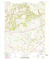
 1951 Adairville1952 Print · USGSAdairville and the Kentucky-Tennessee borderlands are captured here in the early fifties, showing a landscape defined by the Red River and its South Fork. Local historians can trace family roots at Greenwood Cem or locate community hubs like Mortimer Sta and Townsend Sch.3 unique versions available
 - 1951 Map of Dot, 1952 Print
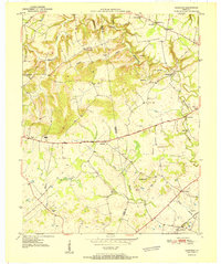
 1951 Dot1952 Print · USGSThe Kentucky and Tennessee borderlands come alive in this early 1950s survey of the Red River valley. Researchers can trace the winding course of Whippoorwill Creek and locate community anchors like Lickskillet, Millertown Ch, and Cedar Grove Sch.3 unique versions available
 - 1951 Map of Prices Mill, 1952 Print
 1951 Prices Mill1952 Print · USGSThe Kentucky-Tennessee state line divides this 1950s farming landscape where the river and local mills defined rural commerce. Genealogists can locate family landmarks and community centers such as Prices Mill, White Hill Ch, and the Red River Sch.2 unique versions available
 - 1951 Map of Auburn, 1953 Print
 1951 Auburn1953 Print · USGSThe Logan and Simpson County line south of Auburn is captured here in the early fifties, showing a rural landscape anchored by rail and road. Researchers can trace historic local congregations like Bethel Grove Ch and schools such as Sand Bank Sch.3 unique versions available
 - 1951 Map of Lewisburg, 1953 Print
 1951 Lewisburg1953 Print · USGSNorth-central Logan County appears here in the early fifties, centered on the railroad town of Lewisburg. Genealogists and local historians can trace the rural landscape through community landmarks like Lost City, Bibbtown Ch, and the Harrison Sch site.2 unique versions available
 - 1951 Map of South Union, 1953 Print
 1951 South Union1953 Print · USGSSouth Union and the Gasper River valley appear here in the early fifties, showing a rural Logan County landscape defined by family farms and rail transport. Genealogists can locate several country churches and burial sites including Felts Cem, Liberty Ch, and the Gasper River Cem.2 unique versions available
 - 1951 Map of Homer, 1953 Print
 1951 Homer1953 Print · USGSLogan County’s rural landscape is captured here in the early fifties, documenting a world of river-bottom farms and upland crossroads. Local researchers can pinpoint family landmarks like Chandlers Chapel, the small settlement of Homer, and Briggs Lake.2 unique versions available
 - 1952 Map of Russellville, 1953 Print
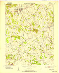
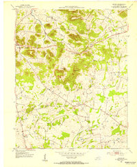
 1952 Russellville1953 Print · USGSMid-century Logan County comes alive in this survey, showing the rail hub of Russellville and its surrounding rural hamlets. Trace family roots and local history through numerous country churches like Lebanon Ch and Whitaker Grove Ch.3 unique versions available
 - 1952 Map of Sharon Grove, 1953 Print
 1952 Sharon Grove1953 Print · USGSThe rural borderlands of Todd and Logan Counties are captured here in the early 1950s, showing a landscape of ridge-top schools and creek-side settlements. Researchers can trace family sites like Tunstall Cem or visit local centers like Sharon Grove and Mineral Spring Ch.3 unique versions available
 - 1952 Map of Dennis, 1953 Print
 1952 Dennis1953 Print · USGSLogan County in the early fifties maintains a landscape of small crossroads communities and family landmarks. Genealogists and historians can trace the rural infrastructure of the era through sites like Mud River Valley Sch, Halls Store, and Bibbs Chapel Com.3 unique versions available
 - 1952 Map of Rockfield, 1953 Print
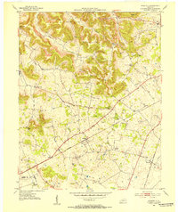 1952 Rockfield1953 Print · USGSWarren County in the early fifties is shown here at a peak of rail and resource activity. Genealogists can locate family landmarks like Millikens Chapel and Sumpter Cem, or trace the development of Rockfield and Rich Pond.2 unique versions available
 - 1953 Map of Rosewood, 1954 Print
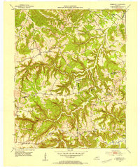 1953 Rosewood1954 Print · USGSThe intersection of Muhlenberg, Todd, and Logan Counties in the early 1950s reveals a classic Kentucky ridge-and-hollow landscape. Genealogists can trace family footprints through rural landmarks like Tyewhoppety, New Harmony Ch, and Greenbrier Sch.
 - 1953 Map of Dunmor, 1954 Print
 1953 Dunmor1954 Print · USGSThe rural borders of Muhlenberg, Butler, and Logan Counties are captured in the early fifties, showing a landscape of ridge-top settlements and river bottomlands. Researchers can find ancestral sites from Old Hebron Ch to Forgys Mill and Hollow Bill.2 unique versions available
 - 1953 Map of Quality, 1954 Print
 1953 Quality1954 Print · USGSButler and Logan Counties in the early fifties reveal a landscape of small rural settlements and an active network of country schools. Genealogists can trace family roots through landmarks like Duncan Cem, Tunnertown (Berrys Lick P O), and the Union Zion Sch.2 unique versions available
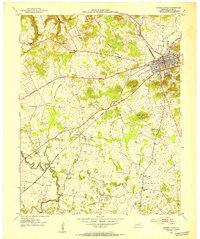
 - 1954 Map of Evansville
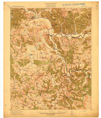
 1954 Evansville1954 Print · USGSThe Ohio River borderlands between Indiana and Kentucky appear here during a period of robust industrial and military growth. Genealogists and researchers can trace the rail corridors of the Illinois Central and find landmarks like US Lock and Dam No 48 or Camp Breckinridge.
 - 1954 Map of Sugar Grove, 1956 Print
 1954 Sugar Grove1956 Print · USGSButler and Warren counties are captured here in the mid-fifties, showing a rural landscape of small crossroads settlements and family farms. Researchers can locate many old burial grounds and country sanctuaries like Richland Ch, New Tuck Cem, and Shiloh Ch.2 unique versions available
Showing maps 1-25 of 122
Top cities of Logan County
- Russellville historical maps
- Auburn historical maps
- Adairville historical maps
- Lewisburg historical maps
Frequently asked questions
- What are the different types of historical maps available for Logan County?
- What is the oldest map of Logan County?
- Where can I purchase historical maps of Logan County for my home or office?
- Where can I download high-res historical maps of Logan County?
- Are there historical topographic maps available for Logan County?
- Is there historical aerial imagery available for Logan County?
- Where are historical maps of Logan County sourced from?