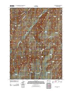
2011 Map of Avery Creek
USGS Topo · Published 2011About this map
Cottonwood Creek and Sixteenmile Creek define the arid drainage basins of this Malheur County landscape, where the management of water is central to the area's utility. The map reveals an extensive system of small-scale water storage, including O'Toole Reservoir, Good Place Reservoir, and Military Reservoir, which likely support the livestock operations characteristic of this high desert region. Settlement is sparse, represented by sites like Indian Camp and the namesake Avery Creek drainage. Transportation is limited to functional routes like Crowley Rd and Keeney Creek Rd, which provide access to remote springs such as Gacey Spring and Cottonwood Cabin Spring. The topography transitions into more defined relief at Box Canyon in the southeast, while the northern reaches are marked by the diverging branches of North Fork Squaw Creek and South Fork Squaw Creek.
Find a feature on this map
34 named features on this map. Tap any name to fly to it.
Don’t see what you’re looking for? This feature index may not catch every label — zoom into the map to look around manually.
Map Details
Editions of this 2011 Avery Creek Map
This is the sole edition of this map. No revisions or reprints were ever made.
Other maps of this area

1955 · Boise
USGS Topo · 1:250,000

1958 · Boise
USGS Topo · 1:250,000

1962 · Boise
USGS Topo · 1:250,000

1966 · Harper
USGS Topo · 1:62,500

1966 · Westfall Butte
USGS Topo · 1:62,500

1972 · Tims Peak
USGS Topo · 1:24,000

1972 · Alder Creek
USGS Topo · 1:24,000

1972 · Avery Creek
USGS Topo · 1:24,000

1972 · Rufino Butte
USGS Topo · 1:24,000
1972 · Hurley Flat
USGS Topo · 1:24,000