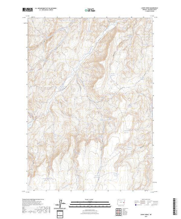
2023 Map of Avery Creek
USGS Topo · Published 2023About this map
Cottonwood Creek and Sixteenmile Creek drain the arid landscape of Malheur County in this 2023 survey. This region is defined by an extensive network of water management features, including several reservoirs named for local families or landmarks such as O'Toole Reservoir, Avery Reservoir, and the uniquely titled Good Place Reservoir. The map reveals a land utilized for ranching and resource management, with sparse transportation routes like Crowley Rd and Keeney Creek Rd navigating the terrain. Notable water sources such as Cottonwood Cabin Spring and Chastain Spring indicate the critical importance of reliable water in this high-desert environment. Several features bear names reflecting indigenous or local heritage, such as Hu-Tsi-Tehaga Creek and Te-he-cha-paa-nena Creek, providing a layer of cultural history to the drainage patterns of the Great Basin's edge.
Find a feature on this map
38 named features on this map. Tap any name to fly to it.
Don’t see what you’re looking for? This feature index may not catch every label — zoom into the map to look around manually.
Map Details
Editions of this 2023 Avery Creek Map
This is the sole edition of this map. No revisions or reprints were ever made.
Other maps of this area

1955 · Boise
USGS Topo · 1:250,000

1958 · Boise
USGS Topo · 1:250,000

1962 · Boise
USGS Topo · 1:250,000

1966 · Harper
USGS Topo · 1:62,500

1966 · Westfall Butte
USGS Topo · 1:62,500

1972 · Tims Peak
USGS Topo · 1:24,000

1972 · Alder Creek
USGS Topo · 1:24,000

1972 · Avery Creek
USGS Topo · 1:24,000

1972 · Rufino Butte
USGS Topo · 1:24,000
1972 · Hurley Flat
USGS Topo · 1:24,000