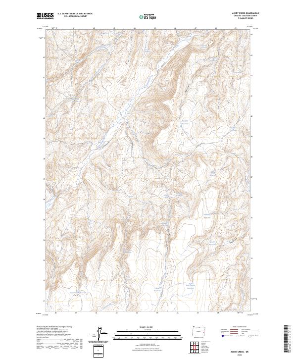
2024 Map of Avery Creek
USGS Topo · Published 2024About this map
Cottonwood Creek and its various tributaries, including Sixteenmile Creek and Avery Creek, carve through the high desert of Malheur County in this recent survey. The landscape is defined by a sophisticated network of water management, evidenced by numerous named catchment points like Petrified Reservoir, Military Reservoir, and Box Canyon Reservoir. These features, alongside isolated water sources like Cottonwood Cabin Spring and Drip Spring, suggest a territory long adapted for livestock or land management rather than concentrated settlement.
Find a feature on this map
40 named features on this map. Tap any name to fly to it.
Don’t see what you’re looking for? This feature index may not catch every label — zoom into the map to look around manually.
Map Details
Editions of this 2024 Avery Creek Map
This is the sole edition of this map. No revisions or reprints were ever made.
Other maps of this area

1955 · Boise
USGS Topo · 1:250,000

1958 · Boise
USGS Topo · 1:250,000

1962 · Boise
USGS Topo · 1:250,000

1966 · Harper
USGS Topo · 1:62,500

1966 · Westfall Butte
USGS Topo · 1:62,500

1972 · Tims Peak
USGS Topo · 1:24,000

1972 · Alder Creek
USGS Topo · 1:24,000

1972 · Avery Creek
USGS Topo · 1:24,000

1972 · Rufino Butte
USGS Topo · 1:24,000
1972 · Hurley Flat
USGS Topo · 1:24,000