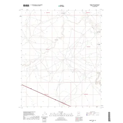
2018 Map of Babbitt Wash
USGS Topo · Published 2018About this map
San Francisco Wash and Babbitt Wash define the drainage patterns of this Coconino County landscape, where the high desert is etched by a series of significant canyons. The terrain transitions from the deep cut of Canyon Diablo in the southeast toward the northern reaches of Locust Canyon and Padre Canyon. This 2018 survey documents a region defined by its topography rather than dense settlement, showing how modern infrastructure like Indian Rte 6910 and the interstate corridor navigate the natural breaks in the land.
Find a feature on this map
15 named features on this map. Tap any name to fly to it.
Don’t see what you’re looking for? This feature index may not catch every label — zoom into the map to look around manually.
Map Details
Editions of this 2018 Babbitt Wash Map
This is the sole edition of this map. No revisions or reprints were ever made.
Other maps of this area

1886 · San Francisco Mtns
USGS Topo · 1:250,000

1891 · San Francisco Mtns
USGS Topo · 1:250,000

1894 · San Francisco Mtns
USGS Topo · 1:250,000

1899 · San Francisco Mtns
USGS Topo · 1:250,000

1947 · Flagstaff
USGS Topo · 1:250,000

1954 · Flagstaff
USGS Topo · 1:250,000

1958 · Flagstaff
USGS Topo · 1:250,000

1960 · Flagstaff
USGS Topo · 1:250,000

1962 · Flagstaff
USGS Topo · 1:250,000
1968 · Elliott Canyon
USGS Topo · 1:24,000