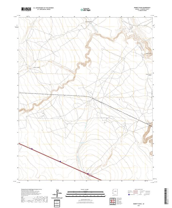
2021 Map of Babbitt Wash
USGS Topo · Published 2021About this map
Babbitt Wash and San Francisco Wash define the drainage patterns of this high desert plateau in Coconino County, where the landscape is marked by a complex network of dry canyons and seasonal watercourses. The prominent presence of Canyon Diablo in the southeast corner suggests the deep geological incisions characteristic of this region. Human activity is centered around transportation and livestock management, evidenced by the modern corridor of Interstate 40 crossing the southern sections and the established route of Indian Rte 6910 to the north.
Find a feature on this map
15 named features on this map. Tap any name to fly to it.
Don’t see what you’re looking for? This feature index may not catch every label — zoom into the map to look around manually.
Map Details
Editions of this 2021 Babbitt Wash Map
This is the sole edition of this map. No revisions or reprints were ever made.
Other maps of this area

1886 · San Francisco Mtns
USGS Topo · 1:250,000

1891 · San Francisco Mtns
USGS Topo · 1:250,000

1894 · San Francisco Mtns
USGS Topo · 1:250,000

1899 · San Francisco Mtns
USGS Topo · 1:250,000

1947 · Flagstaff
USGS Topo · 1:250,000

1954 · Flagstaff
USGS Topo · 1:250,000

1958 · Flagstaff
USGS Topo · 1:250,000

1960 · Flagstaff
USGS Topo · 1:250,000

1962 · Flagstaff
USGS Topo · 1:250,000
1968 · Elliott Canyon
USGS Topo · 1:24,000