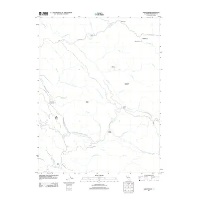
2012 Map of Bailey Ridge
USGS Topo · Published 2012About this map
Bailey Ridge forms the backbone of this Mendocino County landscape, a complex network of timberlands and drainage basins during the early twenty-first century. The map documents a rugged interior geography where traditional family holdings like Leonard Ranch, Scott Ranch, and the Old Bailey Place persist alongside industrial forestry infrastructure. Transportation in this era relied on specialized routes such as the Masonite Industrial Rd and the winding Low Gap Rd, which connects remote clearings like Squaw Opening and Horsethief Opening. The hydrography is defined by the headwaters and tributaries of two major systems: the S Fork Big River to the north and the Little N Fork Navarro River to the south. Small settlements and landmarks like Montgomery and the rock formation known as Castle Garden provide focal points for local history and geographic orientation in this sparsely populated region.
Find a feature on this map
44 named features on this map. Tap any name to fly to it.
Don’t see what you’re looking for? This feature index may not catch every label — zoom into the map to look around manually.
Map Details
Editions of this 2012 Bailey Ridge Map
This is the sole edition of this map. No revisions or reprints were ever made.
Other maps of this area

1920 · Glenblair
USGS Topo · 1:62,500

1922 · Willits
USGS Topo · 1:62,500

1942 · Willits
USGS Topo · 1:62,500

1943 · Glenblair
USGS Topo · 1:62,500

1943 · Boonville
USGS Topo · 1:62,500

1943 · Navarro
USGS Topo · 1:62,500

1944 · Willits
USGS Topo · 1:62,500

1944 · Saddle Point
USGS Topo · 1:62,500

1957 · Ukiah
USGS Topo · 1:250,000
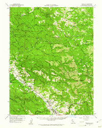
1959 · Boonville
USGS Topo · 1:62,500