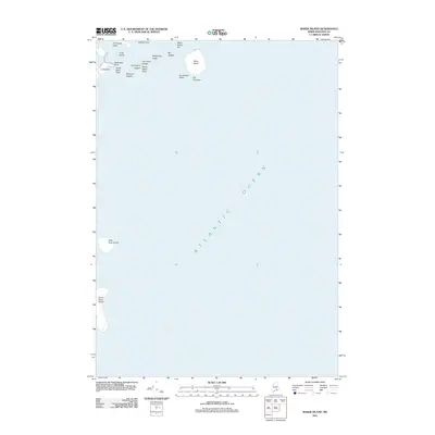
2011 Map of Baker Island
USGS Topo · Published 2011About this map
Baker Island stands as a focal point in this maritime survey, surrounded by a complex network of granite hazards and tidal features in the Atlantic Ocean. The landscape is defined by its exposure to the sea, with named navigation landmarks such as The Thumper and Southwest Rocks marking the submerged periphery of the islands. To the northwest, the terrain of Thrumcap Cape and Deadman Point meets the water, while further offshore, the isolated profiles of Great Duck Island and Little Duck Island dominate the southern portion of the sheet. The survey documents the area's shoreline in detail, including the Baker Island Bar and various named ledges like Whitehorse Ledge and Mackerel Ledges that have long challenged coastal mariners in Hancock County.
Find a feature on this map
18 named features on this map. Tap any name to fly to it.
Don’t see what you’re looking for? This feature index may not catch every label — zoom into the map to look around manually.
Map Details
Editions of this 2011 Baker Island Map
This is the sole edition of this map. No revisions or reprints were ever made.
Other maps of this area

1904 · Mount Desert
USGS Topo · 1:62,500

1904 · Swan Island
USGS Topo · 1:62,500

1904 · Bar Harbor
USGS Topo · 1:62,500

1942 · Bar Harbor
USGS Topo · 1:62,500

1942 · Mount Desert
USGS Topo · 1:62,500

1943 · Swans Island
USGS Topo · 1:62,500

1945 · Swans Island
USGS Topo · 1:62,500

1948 · Bangor
USGS Topo · 1:250,000

1956 · Bar Harbor
USGS Topo · 1:62,500

1956 · Mount Desert
USGS Topo · 1:62,500