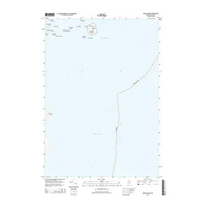
2014 Map of Baker Island
USGS Topo · Published 2014About this map
Acadia National Park encompasses a significant portion of this maritime landscape, specifically the area surrounding Baker Island at the entrance to the Cranberry Isles. The geography is defined by a dense concentration of granite outcrops and navigational hazards such as South Black Rock, Mackerel Ledges, and Whitehorse Ledge. For family historians, the presence of the Gilley Cem on the island provides a specific genealogical anchor in an area otherwise dominated by the ebb and flow of the Atlantic Ocean.
Find a feature on this map
24 named features on this map. Tap any name to fly to it.
Don’t see what you’re looking for? This feature index may not catch every label — zoom into the map to look around manually.
Map Details
Editions of this 2014 Baker Island Map
This is the sole edition of this map. No revisions or reprints were ever made.
Other maps of this area

1904 · Mount Desert
USGS Topo · 1:62,500

1904 · Swan Island
USGS Topo · 1:62,500

1904 · Bar Harbor
USGS Topo · 1:62,500

1942 · Bar Harbor
USGS Topo · 1:62,500

1942 · Mount Desert
USGS Topo · 1:62,500

1943 · Swans Island
USGS Topo · 1:62,500

1945 · Swans Island
USGS Topo · 1:62,500

1948 · Bangor
USGS Topo · 1:250,000

1956 · Bar Harbor
USGS Topo · 1:62,500

1956 · Mount Desert
USGS Topo · 1:62,500