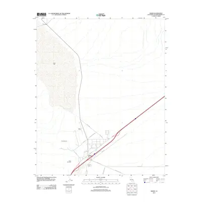
2012 Map of Baker
USGS Topo · Published 2012About this map
Silver Lake dominates the northwestern landscape of this Mojave Desert region, appearing as a broad dry basin north of the settlement of Baker. The town serves as a vital desert crossroads where several significant thoroughfares converge, including E Baker Blvd, Park Ave, and the long desert span of Kelbaker Rd. Just outside the residential and commercial hub, the Baker Airport and a central Po facility provide essential infrastructure for this isolated community. The surrounding terrain is defined by prominent elevations such as Otto Mountain and Nickel Mountain, with primitive desert tracks like Brannigan Mine Rd and Hanks Mountain Rd hinting at the area's prospecting and mining heritage. The map details a transition from the structured town grid to the wide desert washes and alluvial fans that characterize the basin floor.
Find a feature on this map
17 named features on this map. Tap any name to fly to it.
Don’t see what you’re looking for? This feature index may not catch every label — zoom into the map to look around manually.
Map Details
Editions of this 2012 Baker Map
This is the sole edition of this map. No revisions or reprints were ever made.
Other maps of this area

1910 · Ivanpah
USGS Topo · 1:250,000

1912 · Ivanpah
USGS Topo · 1:250,000

1933 · Avawatz Mountains
USGS Topo · 1:250,000

1942 · Ivanpah
USGS Topo · 1:250,000

1947 · Trona
USGS Topo · 1:250,000

1947 · Kingman
USGS Topo · 1:250,000

1948 · Kingman
USGS Topo · 1:250,000

1948 · Trona
USGS Topo · 1:250,000

1953 · Trona
USGS Topo · 1:250,000

1954 · Kingman
USGS Topo · 1:250,000