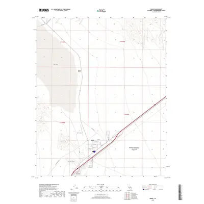
2018 Map of Baker
USGS Topo · Published 2018About this map
Baker serves as a critical junction in the high Mojave Desert, positioned where the 15 freeway meets Highway 127. This 2018 survey detail shows the town's local street grid, including Park Ave and Sheridan Ave, set against a landscape defined by the dry basins of Silver Lake and Soda Lake. The proximity to the Mojave National Preserve is evident along the eastern edge, while the western horizon is dominated by the Soda Mountains, including notable peaks like Otto Mtn and Nickel Mtn. The Baker Airport and local infrastructure like Well Rd and Mill Rd reflect the utility and logistics required for this desert outpost. The terrain is marked by shifting elevations and the stark transition between the flat lakebeds and the rising mountain ranges.
Find a feature on this map
30 named features on this map. Tap any name to fly to it.
Don’t see what you’re looking for? This feature index may not catch every label — zoom into the map to look around manually.
Map Details
Editions of this 2018 Baker Map
This is the sole edition of this map. No revisions or reprints were ever made.
Other maps of this area

1910 · Ivanpah
USGS Topo · 1:250,000

1912 · Ivanpah
USGS Topo · 1:250,000

1933 · Avawatz Mountains
USGS Topo · 1:250,000

1942 · Ivanpah
USGS Topo · 1:250,000

1947 · Trona
USGS Topo · 1:250,000

1947 · Kingman
USGS Topo · 1:250,000

1948 · Kingman
USGS Topo · 1:250,000

1948 · Trona
USGS Topo · 1:250,000

1953 · Trona
USGS Topo · 1:250,000

1954 · Kingman
USGS Topo · 1:250,000