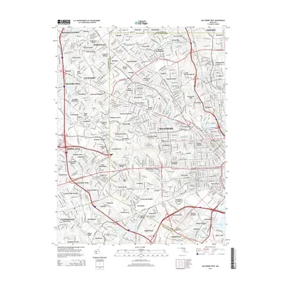
2014 Map of Baltimore West
USGS Topo · Published 2014About this map
Gwynns Falls carves a green corridor through the dense urban and suburban grid of West Baltimore, marking a landscape where historic mill villages like Dickeyville and Franklintown meet modern institutional development. The 2014 terrain is defined by its educational and civic anchors, including the University of Maryland-Baltimore County, Coppin State University, and Baltimore Hebrew University. These campuses sit alongside significant genealogical sites such as Woodlawn Cemetery, Mt Olivet Cemetery, and Saint Peters Cemetery. The map captures the transition from the city’s residential neighborhoods like Walden Circle and Colonial Village to the parklands of Patapsco Woods. Water management is prominent, featuring large-scale infrastructure such as Druid Lake, Ashburton Lake, and the Clear Spring Water Reservoir, highlighting the area's role in the regional water supply system.
Find a feature on this map
140 named features on this map. Tap any name to fly to it.
Don’t see what you’re looking for? This feature index may not catch every label — zoom into the map to look around manually.
Map Details
Editions of this 2014 Baltimore West Map
This is the sole edition of this map. No revisions or reprints were ever made.
Other maps of this area

1892 · Laurel
USGS Topo · 1:62,500

1892 · Ellicott
USGS Topo · 1:62,500

1894 · Ellicott
USGS Topo · 1:62,500

1894 · Laurel
USGS Topo · 1:62,500

1894 · Baltimore
USGS Topo · 1:62,500

1894 · Relay
USGS Topo · 1:62,500

1897 · Laurel
USGS Topo · 1:62,500

1899 · Baltimore
USGS Topo · 1:62,500

1904 · Baltimore
USGS Topo · 1:62,500

1906 · Ellicott
USGS Topo · 1:62,500