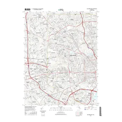
2016 Map of Baltimore West
USGS Topo · Published 2016About this map
Gwynns Falls and Jones Falls carve through the western landscape of this major metropolitan region, anchoring a corridor of diverse residential neighborhoods and historical institutions. The map documents the intricate weave of the city's western edge, from the planned early suburban landscape of Sudbrook Park and Roland Park to the mill-town heritage of Dickeyville and Wetheredsville. Extensive cemetery grounds, including Loudon Park National Cem and Mount Olivet Cem, provide significant genealogical landmarks across the rolling terrain.
Find a feature on this map
111 named features on this map. Tap any name to fly to it.
Don’t see what you’re looking for? This feature index may not catch every label — zoom into the map to look around manually.
Map Details
Editions of this 2016 Baltimore West Map
This is the sole edition of this map. No revisions or reprints were ever made.
Other maps of this area

1892 · Laurel
USGS Topo · 1:62,500

1892 · Ellicott
USGS Topo · 1:62,500

1894 · Ellicott
USGS Topo · 1:62,500

1894 · Laurel
USGS Topo · 1:62,500

1894 · Baltimore
USGS Topo · 1:62,500

1894 · Relay
USGS Topo · 1:62,500

1897 · Laurel
USGS Topo · 1:62,500

1899 · Baltimore
USGS Topo · 1:62,500

1904 · Baltimore
USGS Topo · 1:62,500

1906 · Ellicott
USGS Topo · 1:62,500