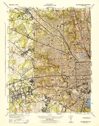
1944 Map of Baltimore West
USGS Topo · Published 1944About this map
Pimlico Race Track and the sprawling grounds of Spring Grove State Hospital anchor this wartime view of the city's western edge. The landscape is defined by a dense concentration of religious and social institutions, from the St Josephs Monastery to the St Marys Industrial School, reflecting a period of significant institutional presence in the suburbanizing corridor. Major transportation arteries like Reisterstown Road and the Western Maryland RR cut through established neighborhoods such as Arlington and Forest Park, while the wooded valley of Gwynns Falls provides a natural break in the expanding grid.
Find a feature on this map
95 named features on this map. Tap any name to fly to it.
Don’t see what you’re looking for? This feature index may not catch every label — zoom into the map to look around manually.
Map Details
Editions of this 1944 Baltimore West Map
This is the sole edition of this map. No revisions or reprints were ever made.
Other maps of this area

1892 · Laurel
USGS Topo · 1:62,500

1892 · Ellicott
USGS Topo · 1:62,500

1894 · Ellicott
USGS Topo · 1:62,500

1894 · Laurel
USGS Topo · 1:62,500

1894 · Baltimore
USGS Topo · 1:62,500

1894 · Relay
USGS Topo · 1:62,500

1897 · Laurel
USGS Topo · 1:62,500

1899 · Baltimore
USGS Topo · 1:62,500

1904 · Baltimore
USGS Topo · 1:62,500

1906 · Ellicott
USGS Topo · 1:62,500