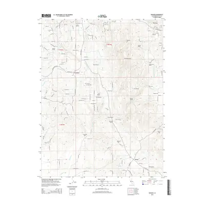
2015 Map of Bangor
USGS Topo · Published 2015About this map
The Sierra Nevada foothills of Butte County are defined by a complex network of ravines and gulches feeding the N Honcut Cr drainage system. Settled centers like Bangor and Wyandotte anchor the landscape, while smaller locales such as Hurleton and Swedes Flat mark higher elevations. This 2015 survey reveals an intricate hydraulic infrastructure, where the Palermo Canal, Bangor Ditch, and Henderson Ditch lace across the contours of the terrain. The topography is deeply incised by family-named and descriptive features, including Dutch Ravine, French Ravine, and Fine Gold Gulch. Local landmarks like Rattlesnake Point and Phoenix Hill provide prominent elevation markers, while the Oak Grove Cemetery serves as a vital touchpoint for those researching the genealogy of these foothill communities. The map highlights the transition between the flat Sacramento Valley to the west and the rising ridges where the Upper Rocky Honcut Cr originates.
Find a feature on this map
111 named features on this map. Tap any name to fly to it.
Don’t see what you’re looking for? This feature index may not catch every label — zoom into the map to look around manually.
Map Details
Editions of this 2015 Bangor Map
This is the sole edition of this map. No revisions or reprints were ever made.
Other maps of this area

1888 · Marysville
USGS Topo · 1:125,000

1888 · Smartsville
USGS Topo · 1:125,000

1888 · Bidwell Bar
USGS Topo · 1:125,000

1891 · Bidwell Bar
USGS Topo · 1:125,000

1891 · Chico
USGS Topo · 1:125,000

1891 · Marysville
USGS Topo · 1:125,000

1891 · Smartsville
USGS Topo · 1:125,000

1892 · Smartsville
USGS Topo · 1:125,000

1893 · Chico
USGS Topo · 1:125,000

1893 · Bidwell Bar
USGS Topo · 1:125,000